(8/31/06 - 9/04/06)
![]()
On this page are pictures and descriptions from 8/31/06 - 9/04/06. Click on any picture or panorama for an ENORMOUS version. Click here to go to the homepage and get a description of what this is all about.
This webpage, and all of http://www.ski-epic.com are yours to enjoy. Feel free to use any pictures found here for any purpose you like, with or without credit. I grant you full rights, for free, forever, to do anything you want, including redistribute the pictures with or without any credit to me. This isn't my job, it's just my vacation website. Enjoy!

(Read
a personal
description of Backblaze here.)
END OF NEW ADDITION, now on to the original website->
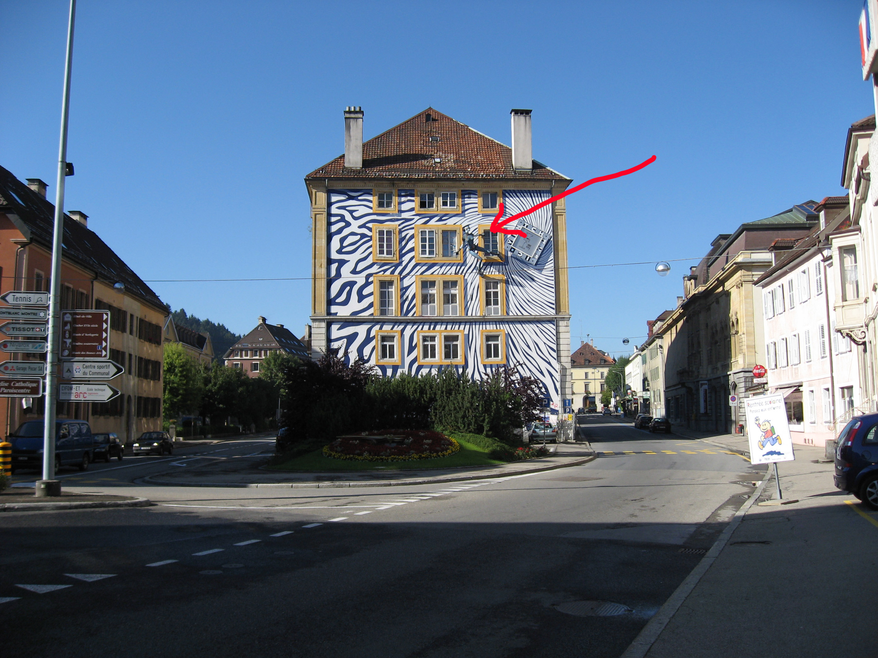
In some random town in France we ran across this sculpture on the side of a building, thought it was neat. (Notice where the red arrow points.) This was on Thursday, 8/31/06.
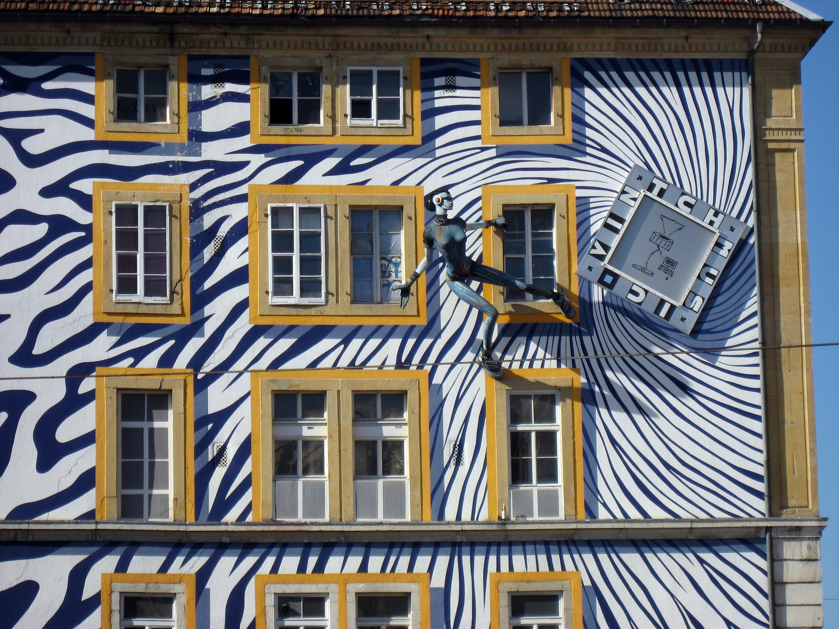
A closer in picture of the sculpture.
Late in the day we found a TINY little road leading up the west side of the lake "Lac du Bourget" near the town of Aix-Les-Bains in France and decided to take it. The road had AMAZING views of the lake. Below is a small cafe you can sit a thousand feet over the lake and watch the boats.
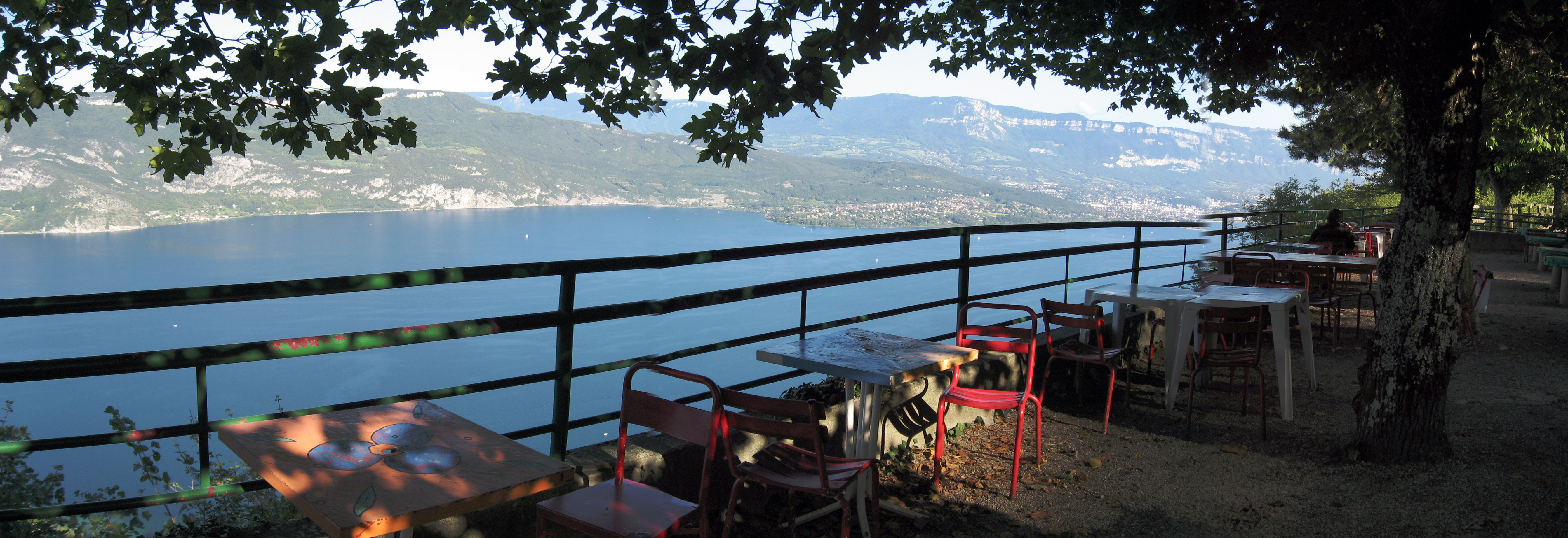
The view from the cafe.
A little further on, we stopped at this random switchback to take a picture. Our motorcycles are on the left.
The same spot as above, a close up with BrianB in it.
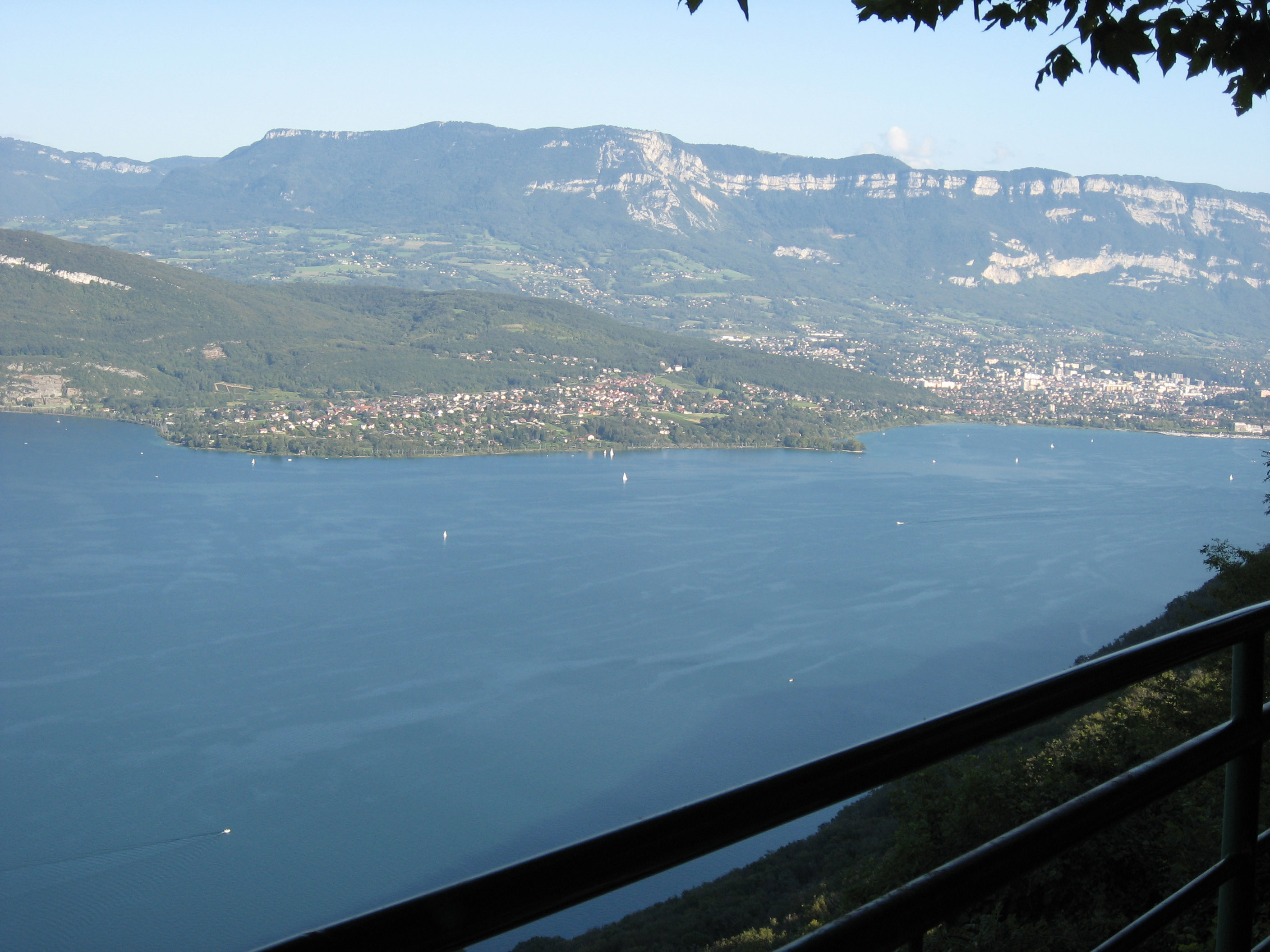
The town we see on the opposite side of the lake is Aix-Les-Bains, France. We have to reach the opposite side of that town and keep going to reach our destination (Talloires, France) and the sun is starting to go down. This photo was taken about 6pm.
Whew! Here we are on the opposite side of the lake, just past the town, and this picture was taken at 7pm, a full hour later! That took a little longer than we expected, and now we're late for dinner. :-) But look at the view below of the lake (Lac du Bourget), it's beautiful. We get into our hotel (and dinner) about 8pm just as the sun disappeared completely and it went dark.
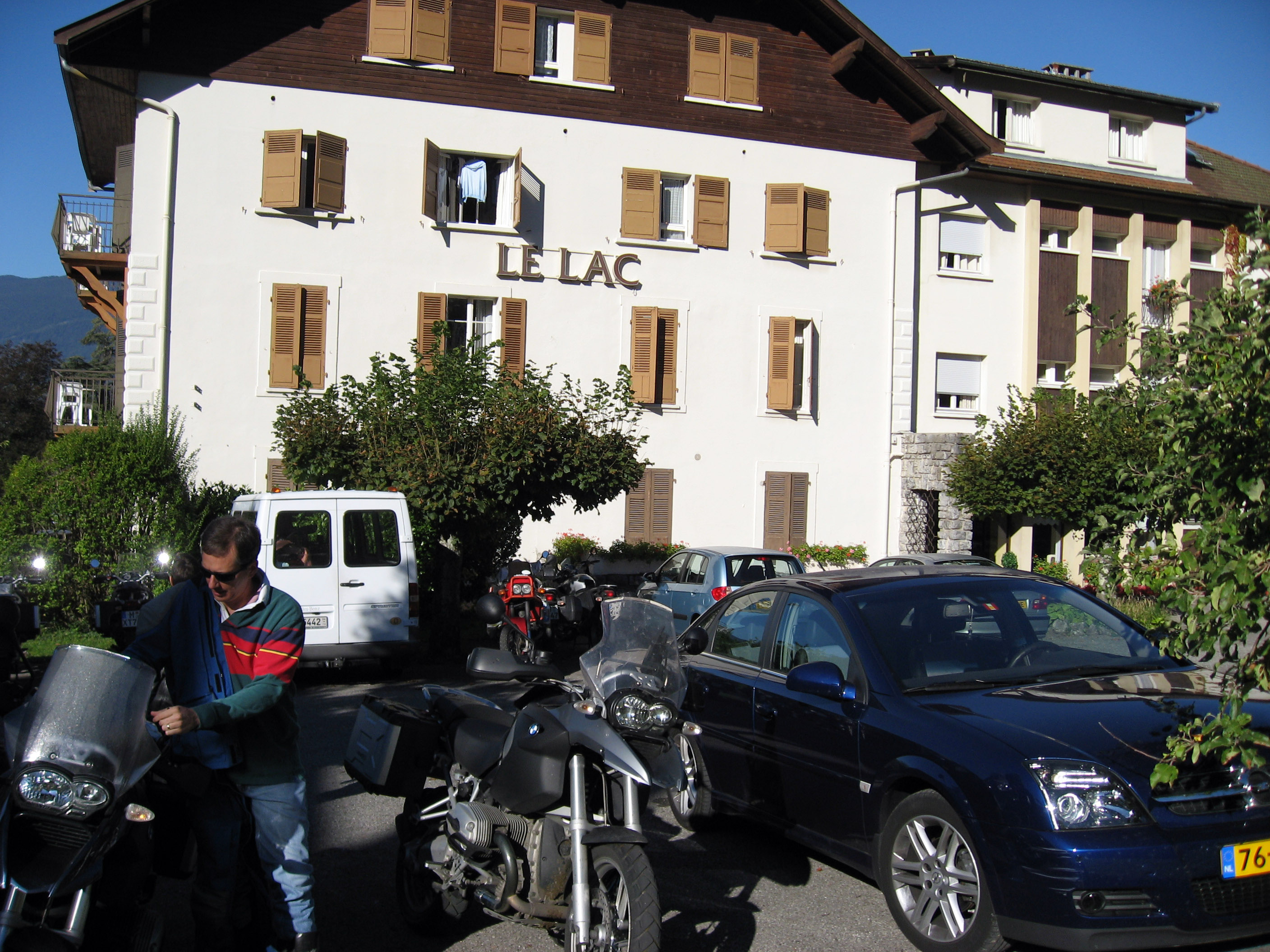
On Friday, 9/1/06 it was a potential "day off" (two nights in a row in the same hotel so you can rest if you like), but I wanted to scout out Chamonix, France for an upcoming ski trip. Peter and Jane Manchester were going in the same direction, and BrianB was game, so we all headed off to Chamonix. The picture below is getting ready in the hotel parking lot.
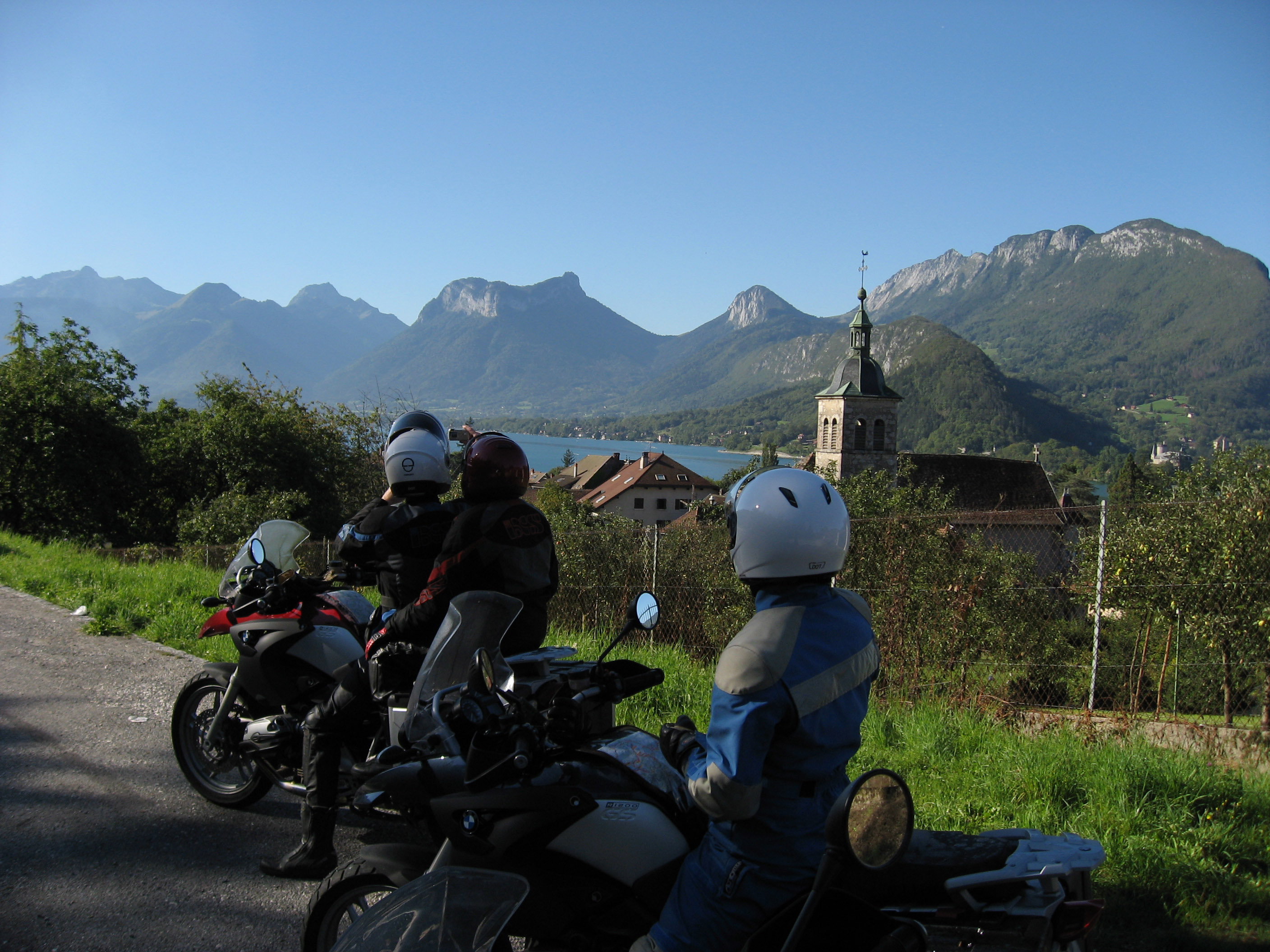
A half a mile down the road, we stopped to take a picture of the Lake that our hotel is next to. The lake is called "Lac d' Annecy", and the town we are in is Talloires, France. It is very, very pretty.
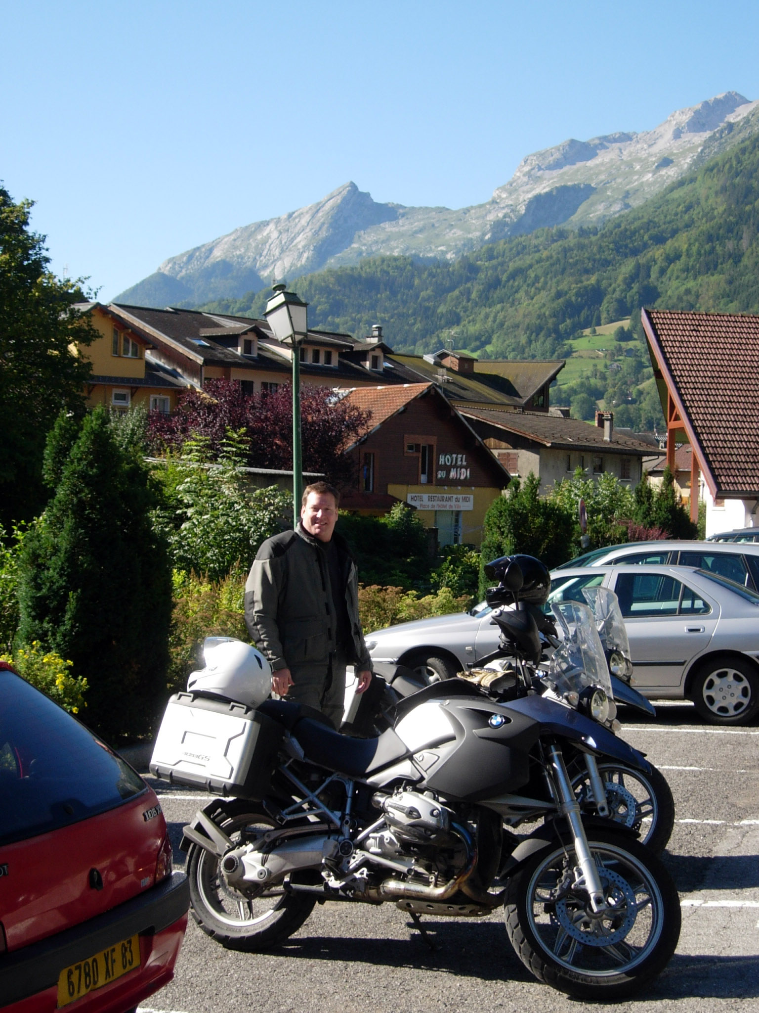
Below I am in a parking lot waiting to meet up with a couple other riders who are getting gas for their motorcycles. It is 9/1/06 and we are on our way to Chamonix, France on the motorcycles. Picture by BrianB.
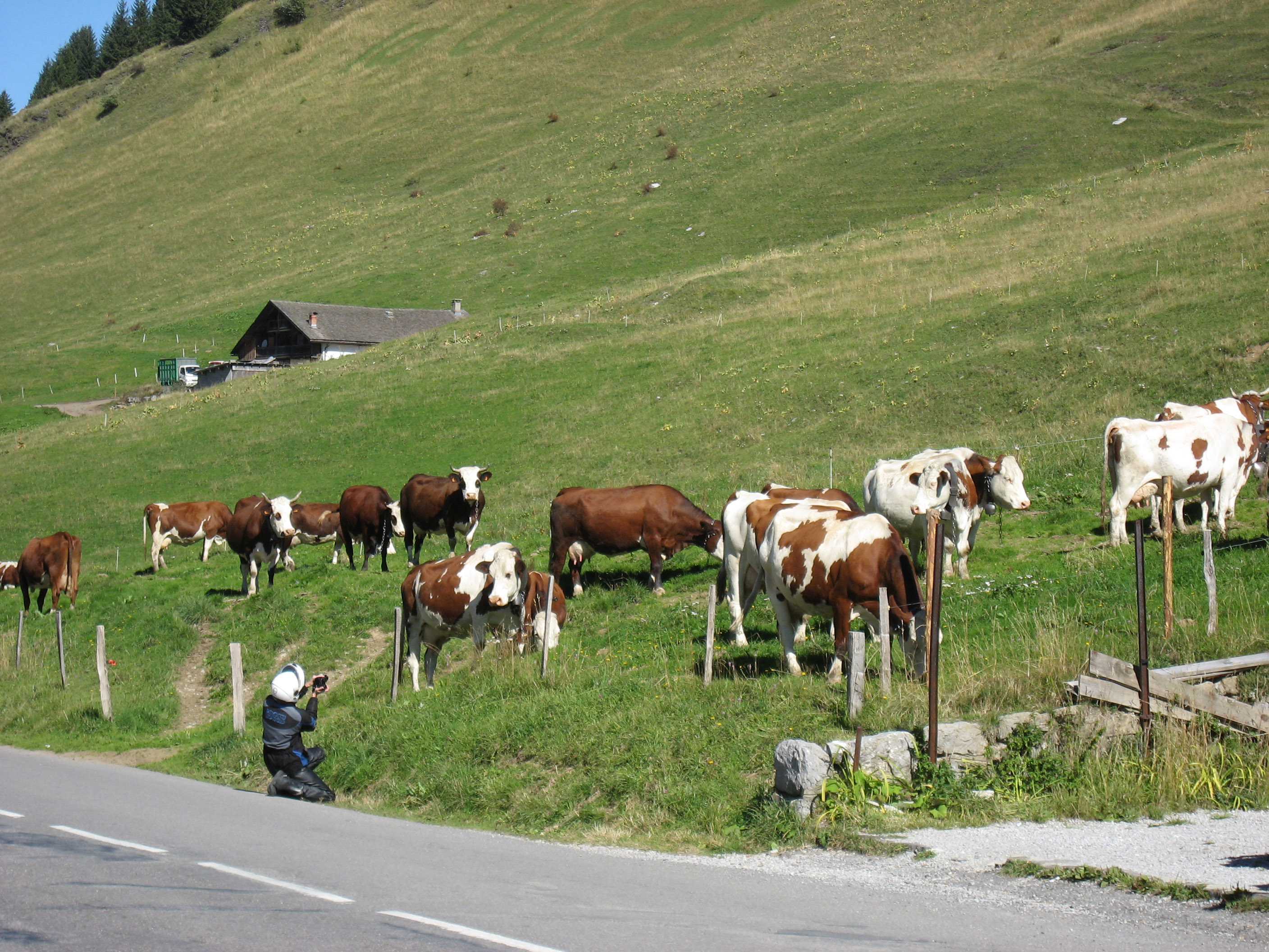
At the first pass, here is Peter photographing cows.
Here are our bikes waiting for us.
Below is a pretty spot we stopped to take a photo. I believe the town down below might be Megeve, France.
An artsy photo of the motorcycle with the mountains in the distance.
In the picture below, if you squint (or click on the photo to zoom in) you can see a paraglider (white spot in the middle of the blue sky).
The bottom of the tram at Chamonix, France.
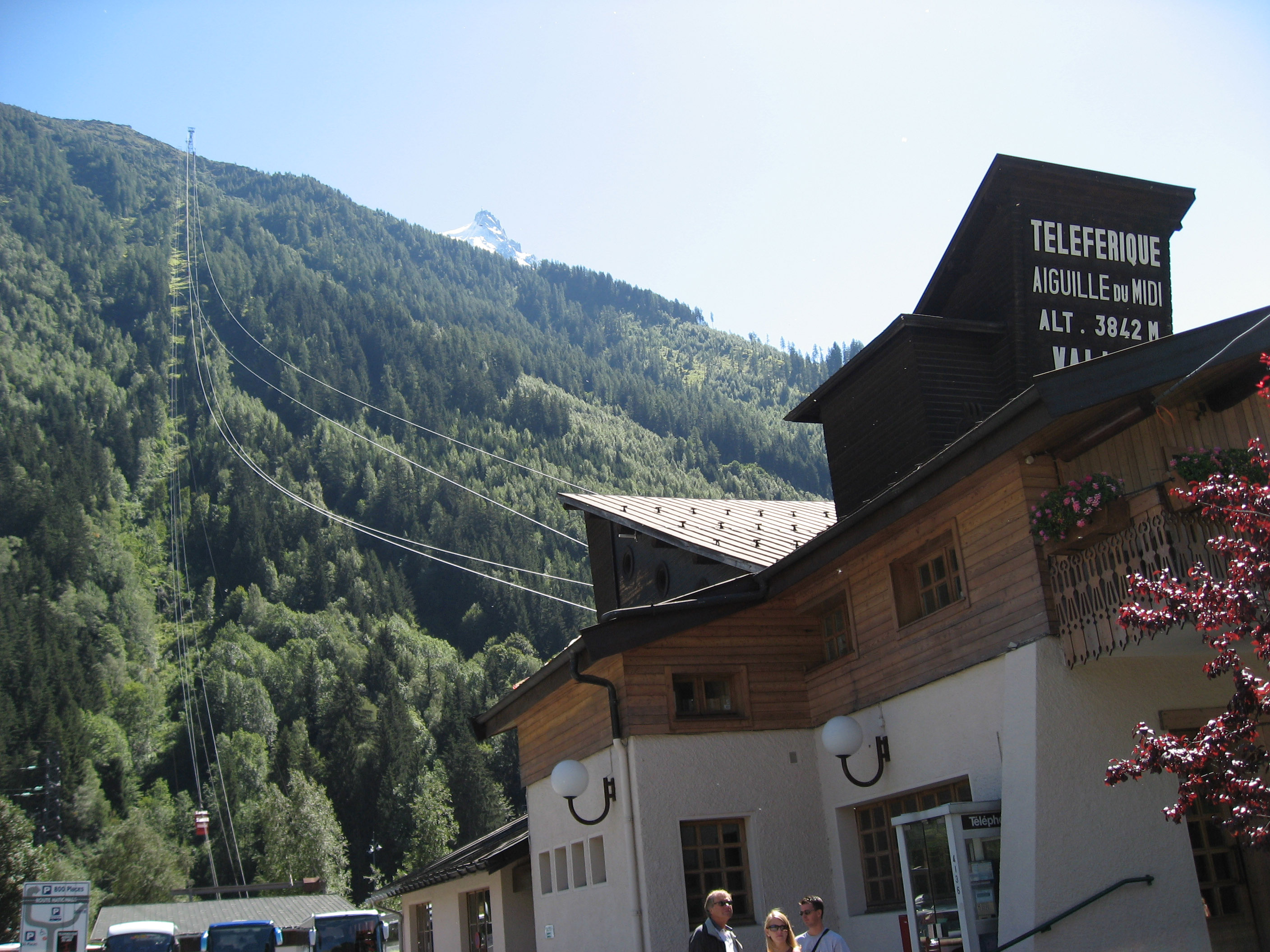
Picture of the busy town area just behind the tram (for future reference for my ski trip later).
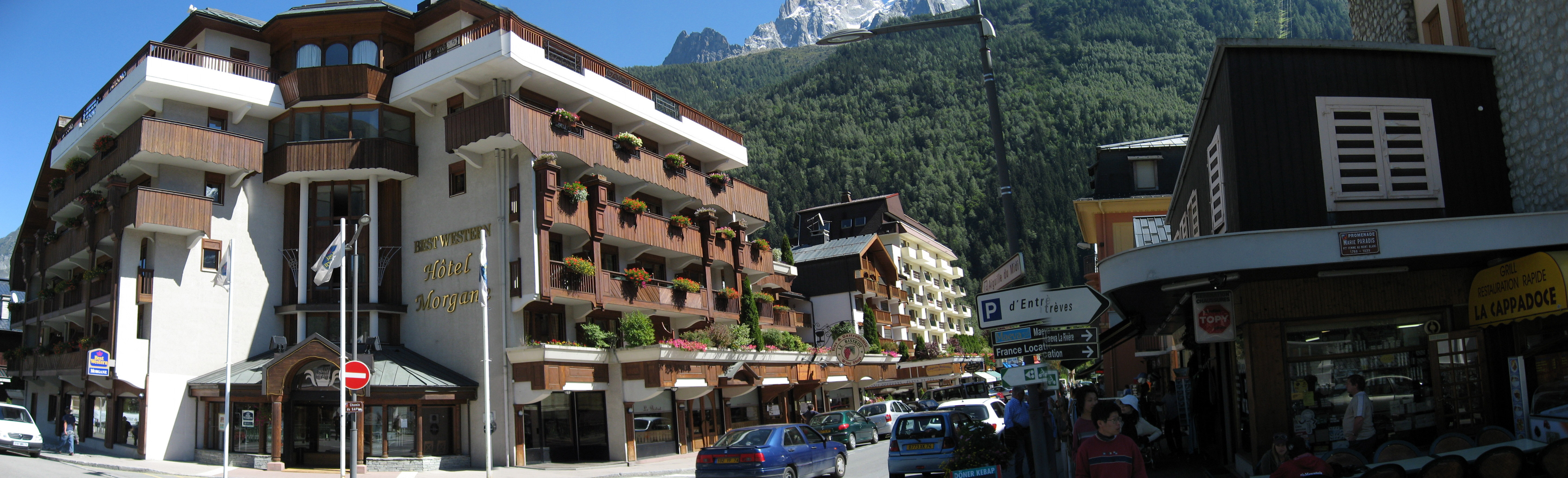
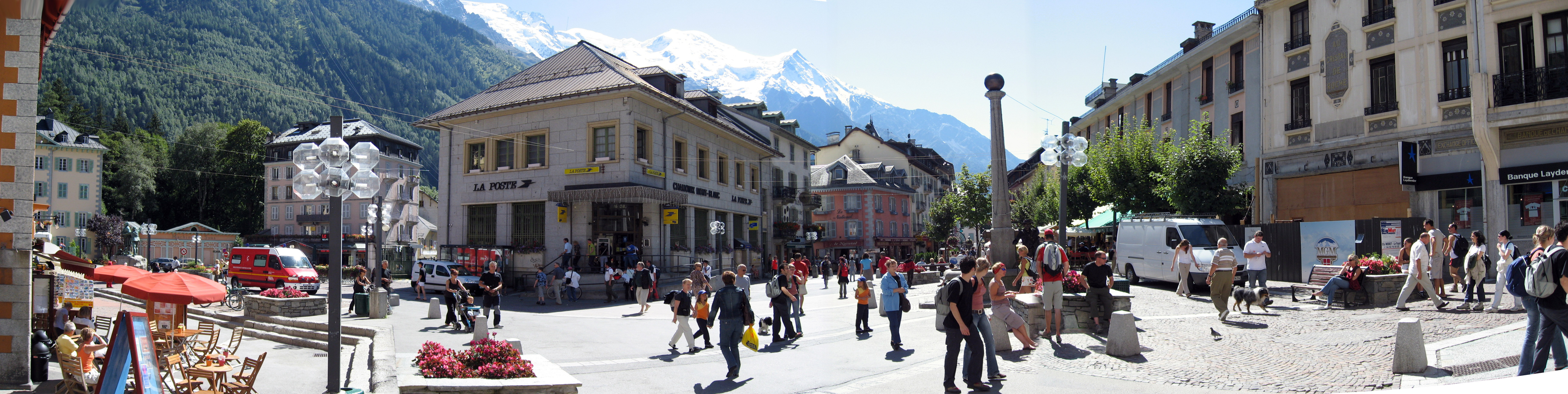
This area (around the post office in Chamonix, France) is even busier, more restaurants and bars right here, but would be a shuttle ride to the tram.
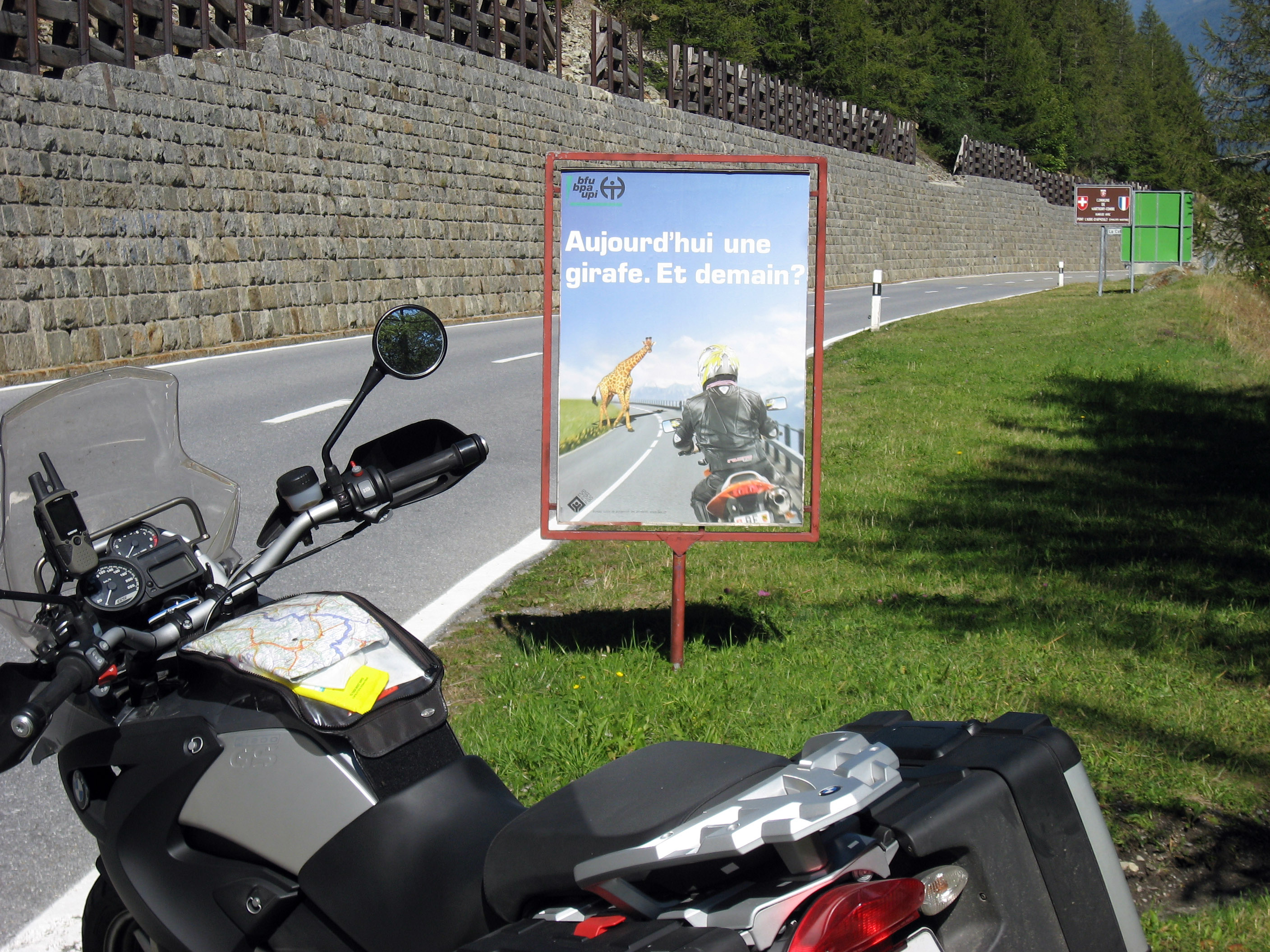
On the way home I saw this sign. It seems to say "Motorcyclists should watch out for French Giraffes". I'm serious, that's a picture of a Giraffe!! French people are strange.
A scenic stop I took this picture. The town below in the valley to the left is Martigny, France.
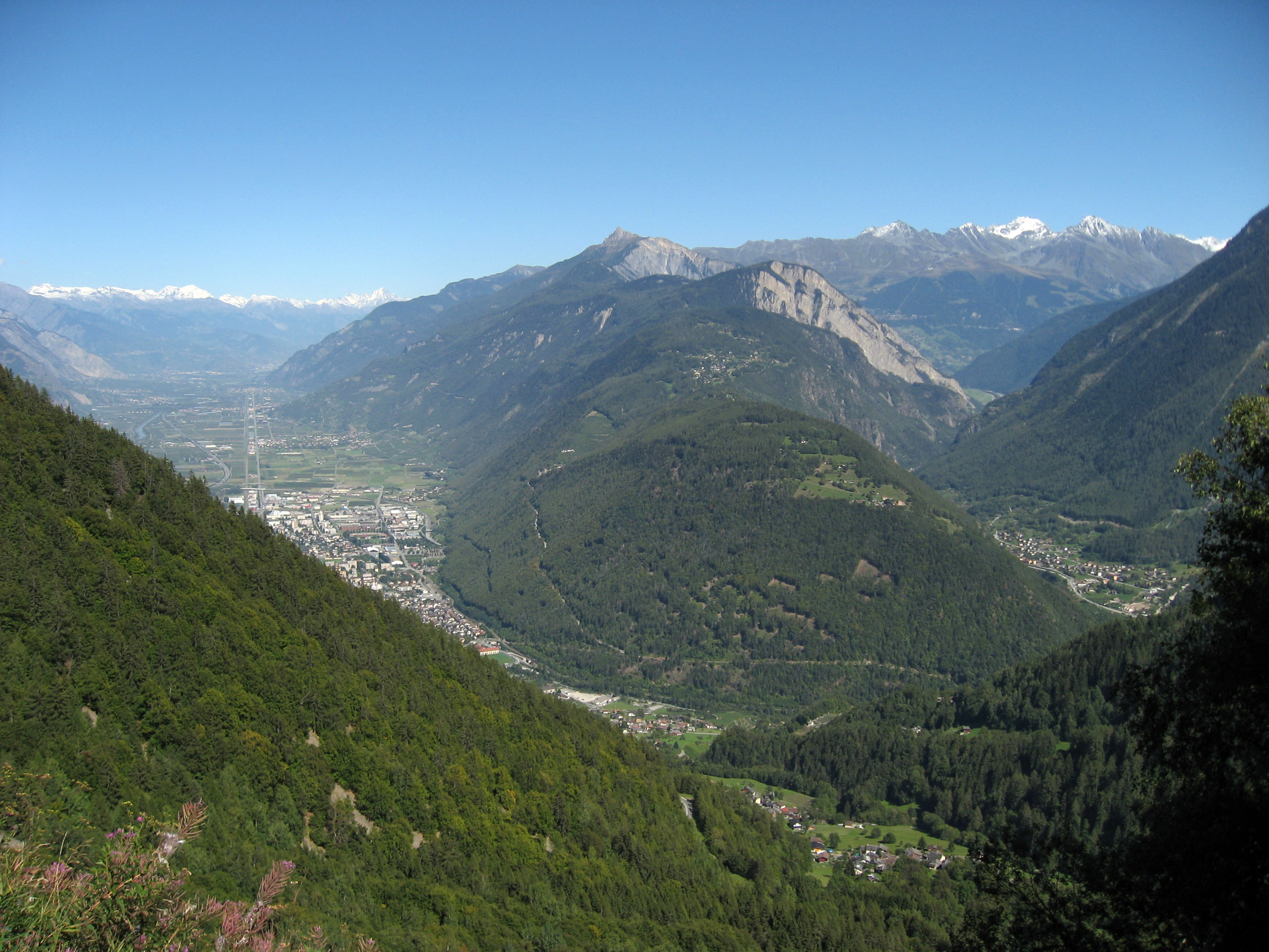
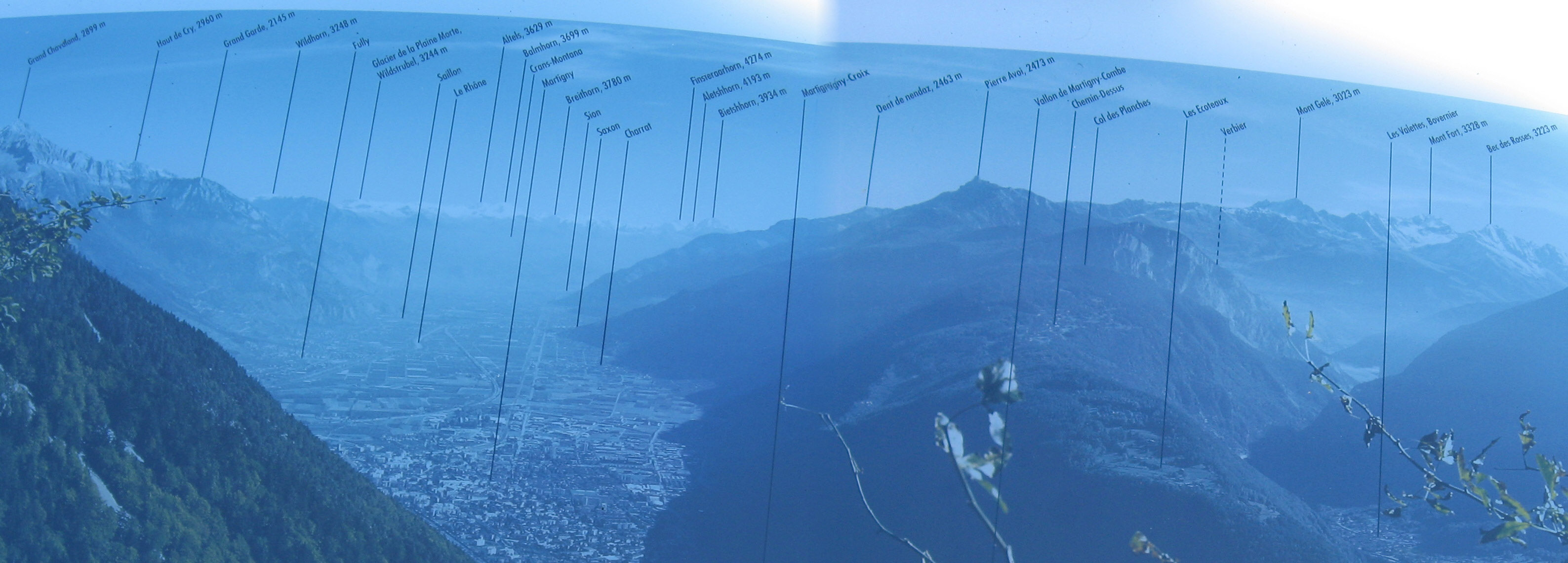
Here is a plaque which describes what you see in my picture above. :-)
Down in the valley in one of the little towns I passed this sculpture of a motorcycle sticking out of a brick wall. Kind of amusing.

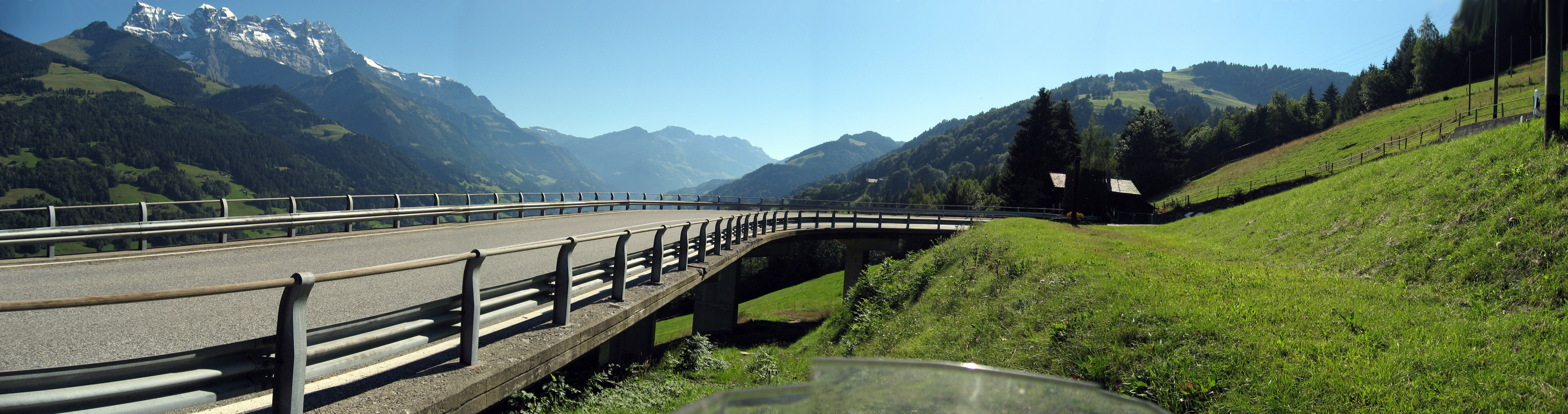
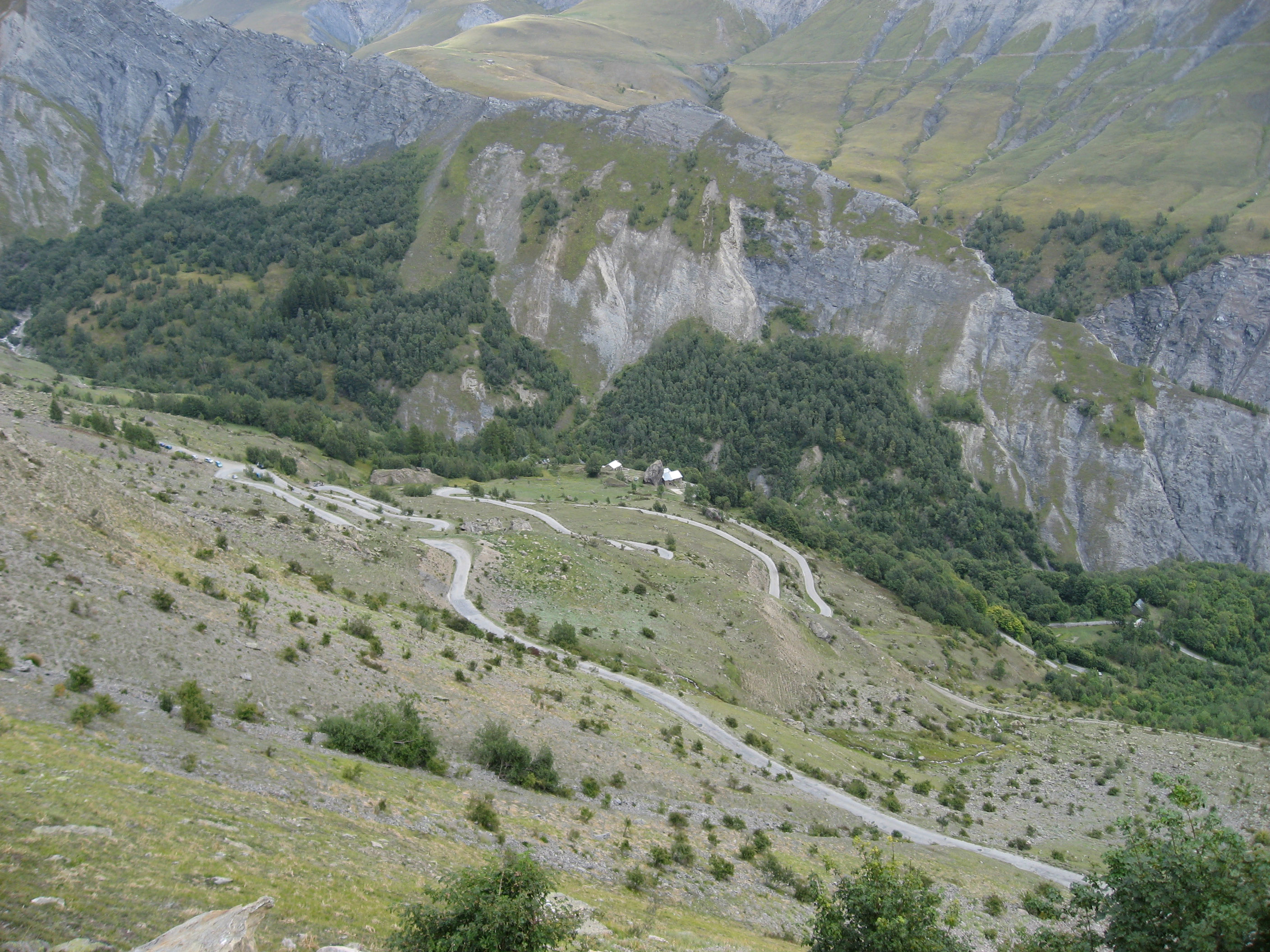
Check out these switchbacks. They have to stilt them off the ground to get the road to make it around the switchback.
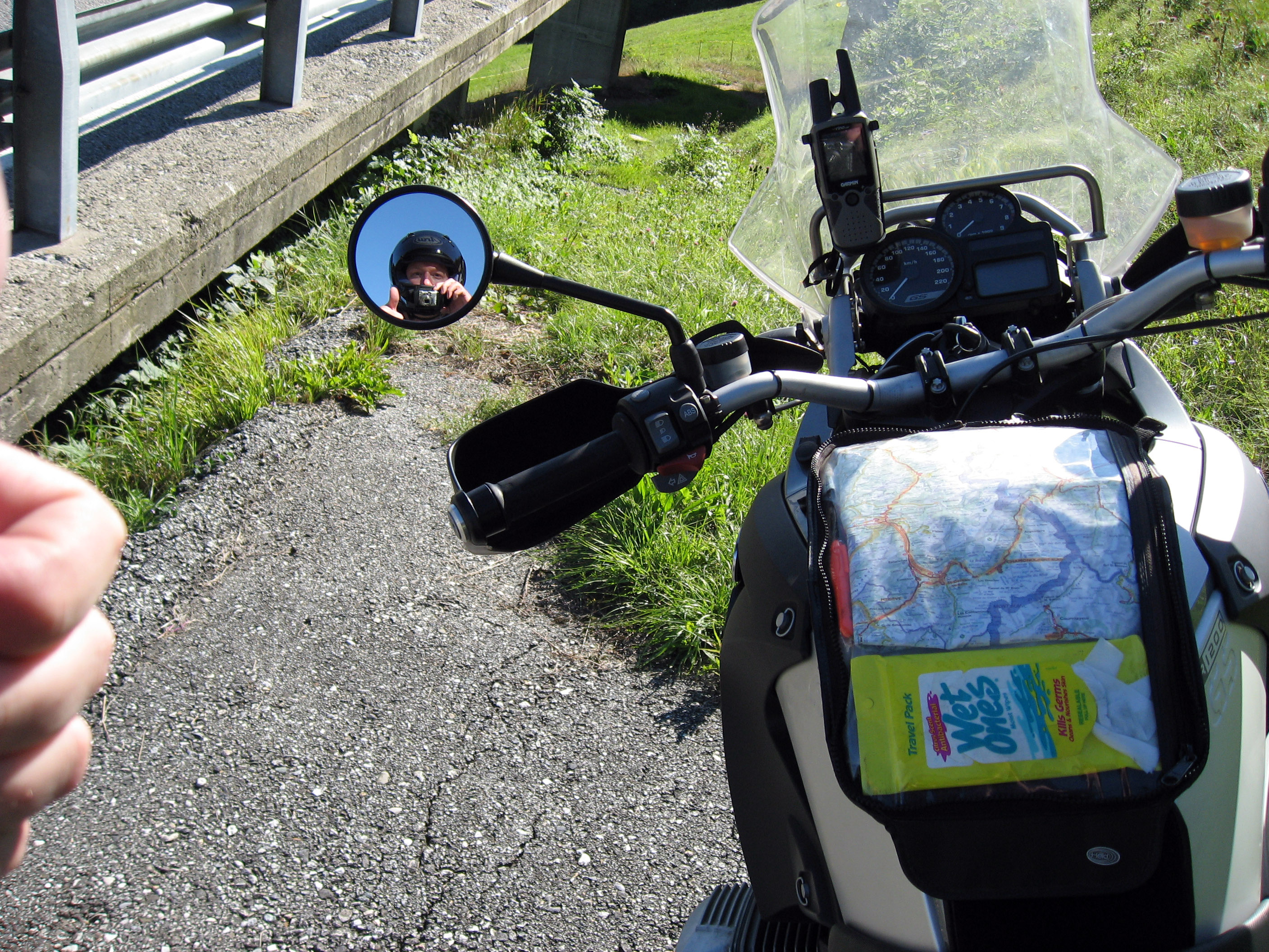
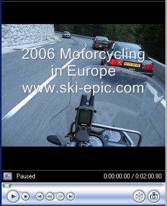
To have some fun, I taped my Canon SD700IS camera to my helmet with some electrical tape, and then I filmed a movie of driving through a few Europe switchbacks on the BMW R1200GS motorcycle. Since I am alone at this point, I could only take a photo by looking in my motorcycle's mirror (because the camera was now taped to my helmet!) Look closely in this photo and you can see the black electrical tape boxing in the camera.
Click the movie picture below or click here to download and watch a movie taken from the "Helmet Camera" (it is zipped, so you will need to unzip it first, then play it). THIS IS ENORMOUS (30 MB) and you will not see any progress, so you will need to wait and wait and WAIT to get the results. Just be patient.
I stopped at this spot, and walked off the road a ways trying to get a clear picture of that set of switchbacks in the distance, but it didn't really come out well.
We got up the next day on Saturday, 9/2/06 in Talloires, France, and drove the BMW motorcycles to Guillestre, France. Below you see the normal scene in the morning as people drop their bags off near the van (big white thing on the left) and prep their gear for a wonderful day of riding. I had a few moments so I snapped off a few photos.

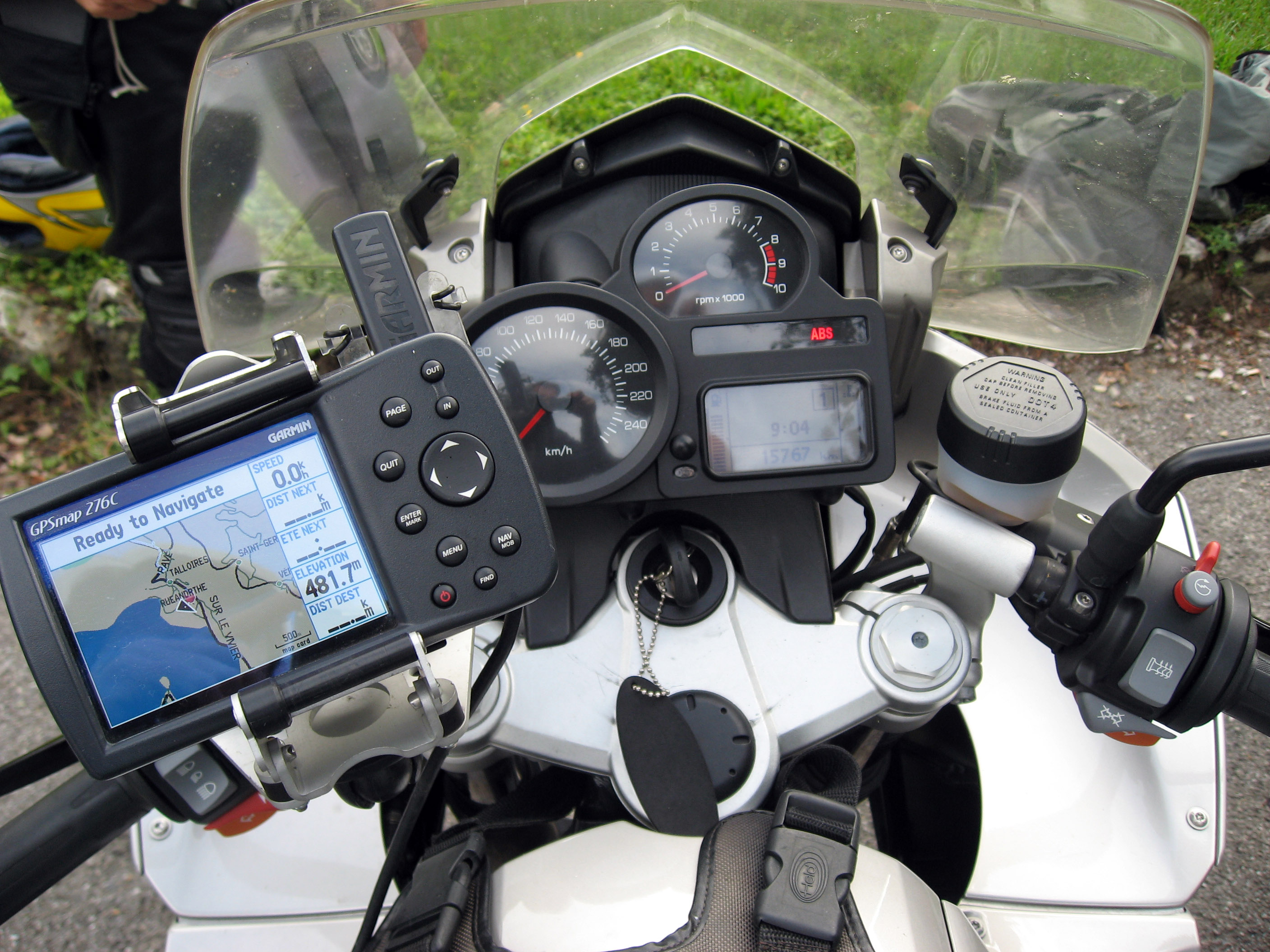
Below is the GPS rig the tour will rent you if you like. It is a Garmin 276C, mounted with a Touratech mount.
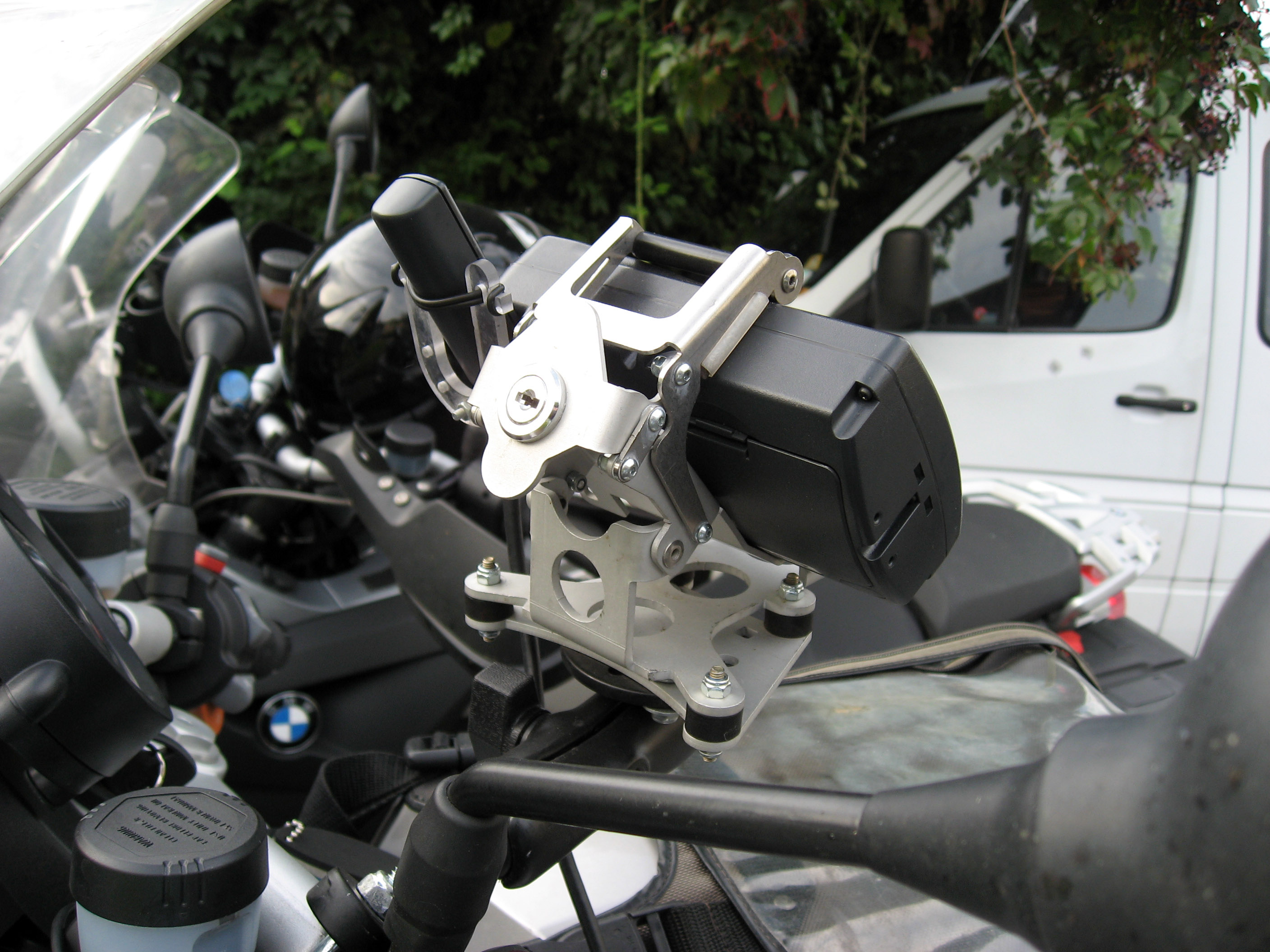
A picture of the back of the Touratech mount holding the GPS on this motorcycle.
Below is the BMW I rode for the whole trip, mounted with a Garmin Rino 530 GPS (click here for more info on my GPS) and a map case on the tank. (Click on the picture below to get a really big zoomed in version.) The only reason I brought my own GPS was so I didn't have to learn the new interface of a different GPS, but the 276C is a bigger, better, faster GPS than my Rino and I might opt for that next time. Less than half the motorcycles had a GPS of one sort or another, but I feel it is a fantastic addition. You always know EXACTLY where you are, and what direction you need to go. In Europe, on the small roads we are on, you can get incredibly lost and turned around. Before GPS, we have spent hours and hours lost, studying maps by the side of the road and making guesses. I'll never tour in Europe without a GPS ever again, period.
Al Walker talking with BrianB. Al is the mechanic along on the tour, and drives "Mertle", the big white van hauling all the luggage from hotel to hotel for us.
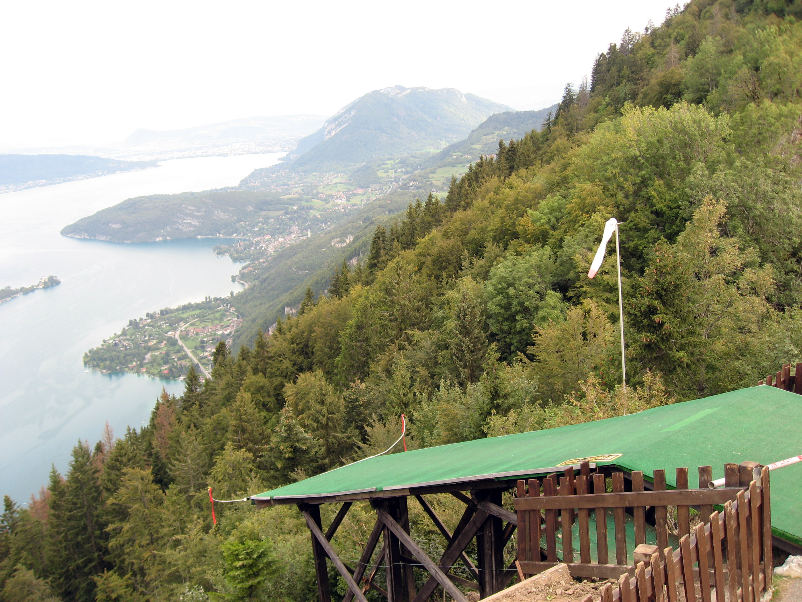
Below is a panorama overlooking a lake in France. The lake is "Lac d'Annecy" and the largest town on the side of this lake is "Talloires". This paraglide launch point is at "Col de la Forclaz" (which is a small mountain pass on a small road) and the altitude is 1104 meters. Use your horizontal scroll bar on the browser to see the whole thing, or click on the picture for a HUGE version.
A slightly different angle to see it is a fast trip to nowhere.
Another slightly different angle to see the whole 15 foot long launch pad. Look at the windsock! It's insane, it's like a big joke.
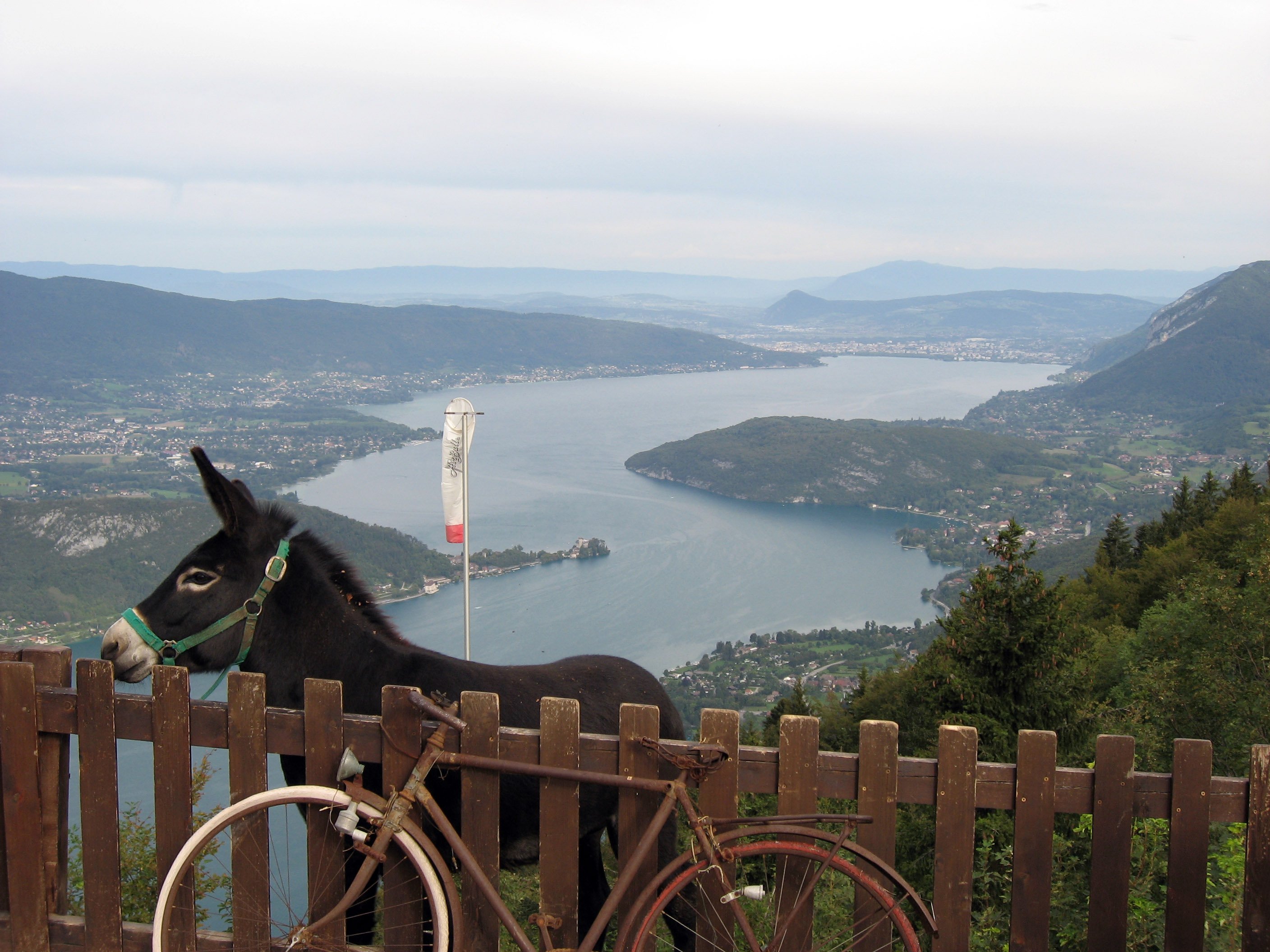
This donkey was sitting right behind the wooden fence, I guess he brays in laughter every time a paraglider or handglider falls off the end of the launch pad and dies.
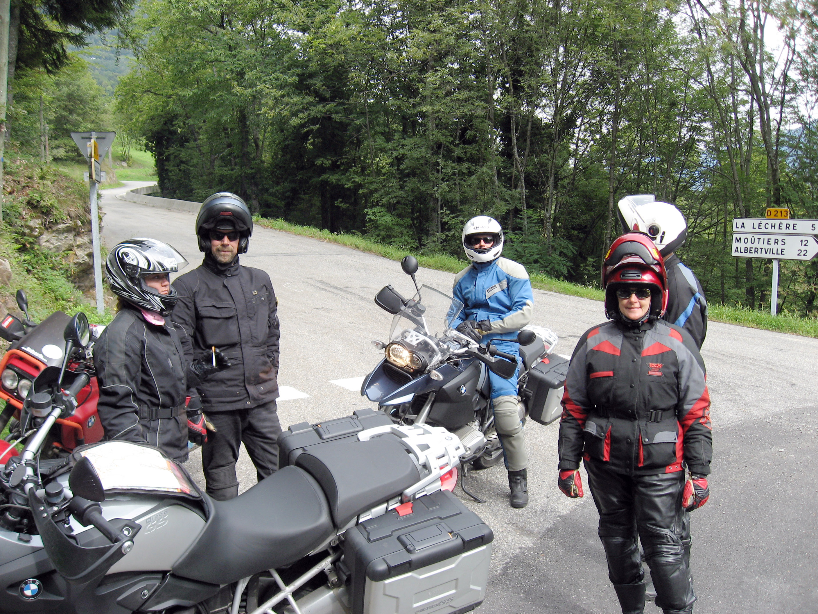
A little while later in the day we started climbing towards Col de la Madeleine, France and ran into the tour guide Rob Beach and drove with him and some others for a few hours, which is always very fun. From left to right in the photo below are Gretchen, Rob Beach, BrianB in back in blue on the bike, Jane in front and Peter hidden in back.
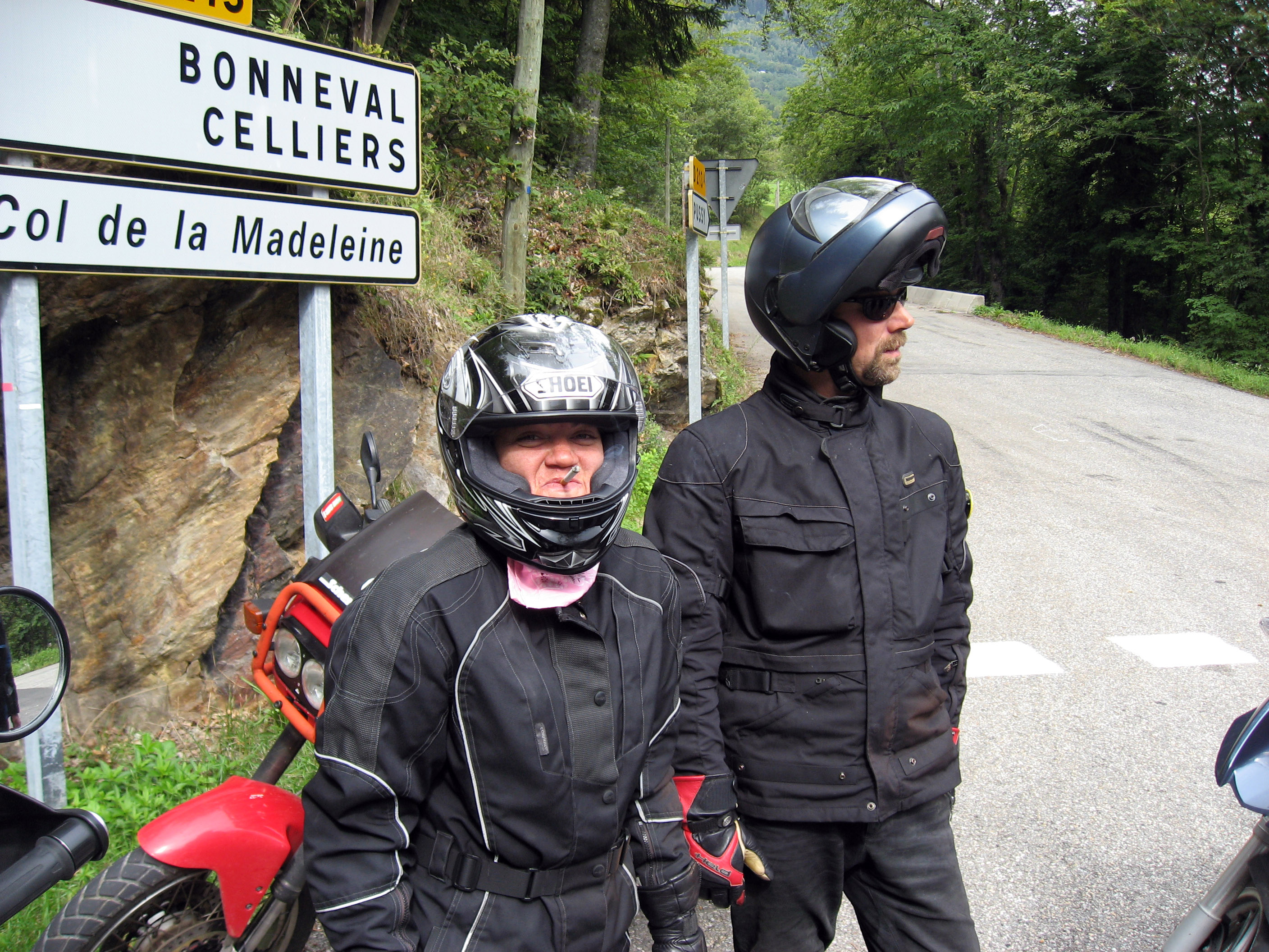
I love the photo below of Gretchen smirking as she smokes through her helmet. Rob (tour owner) is on the right. Rob has one of the high tech helmets that you can hinge the jaw up over your head which is very convenient.
The picture below was taken on 9/2/06, I am on the far left in the picture. We ran into these other riders on our tour, left to right is Gretchen (in back holding up a gloved hand), Jane Manchester (in red), Rob Beach (the tour guide owner), and on the far right with blue parts on his jacket is Peter Manchester. Picture by BrianB. We are all heading up to Col de la Madeleine, France on our motorcycles (you can see the sign behind us).
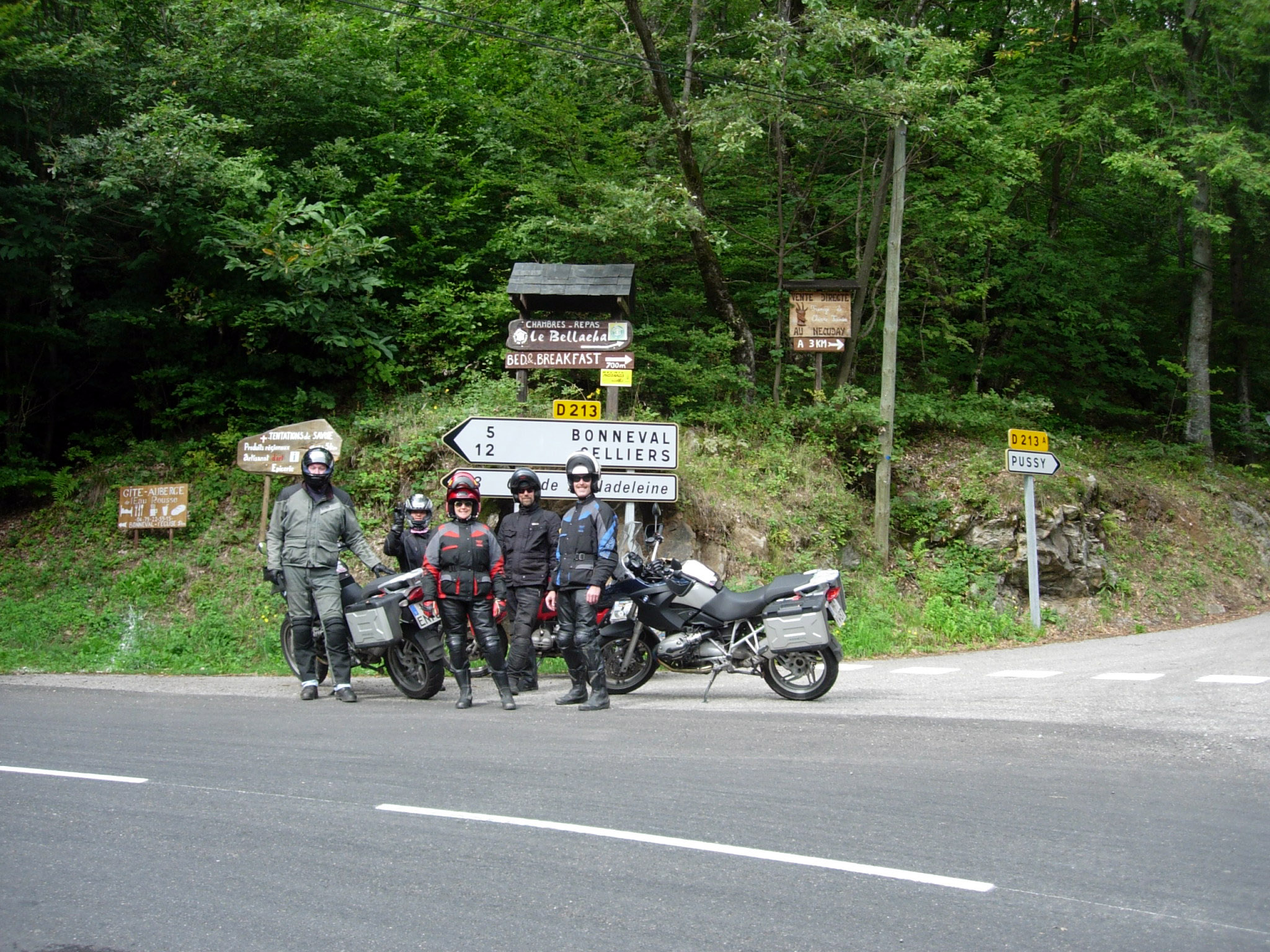
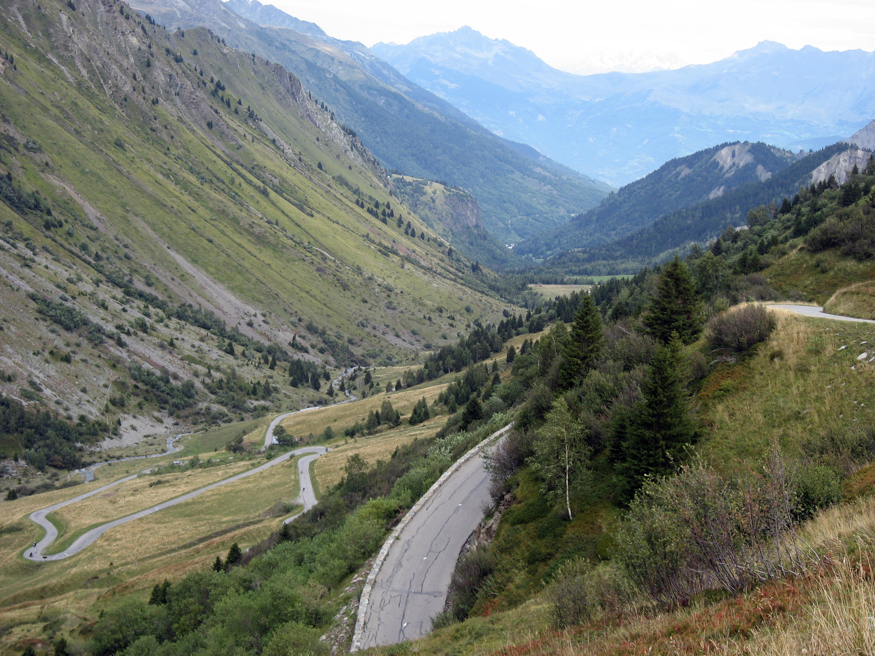
A picture of the road we just drove on climbing up towards Col de la Madeleine, France.
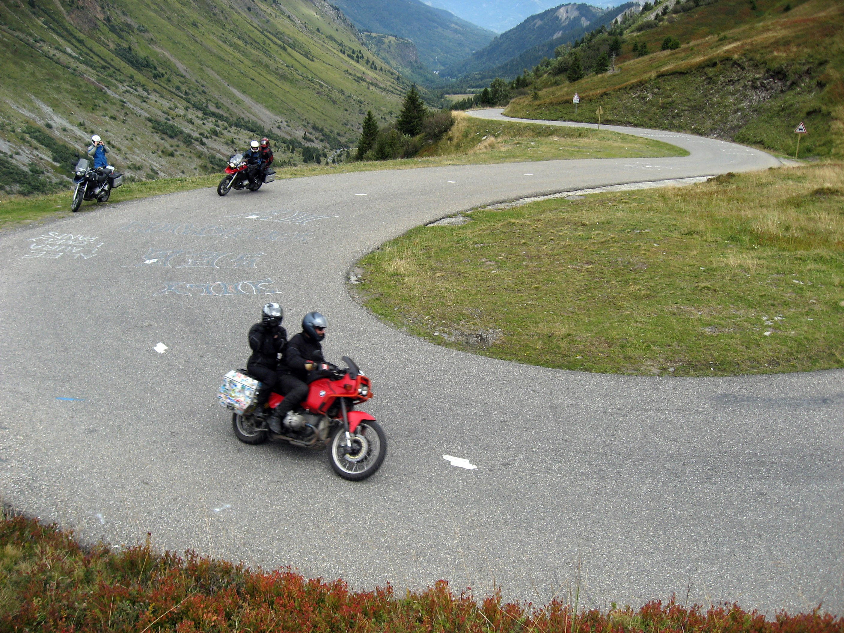
Below on "The Red Devil" (1989 (?) BMW R80GS (?) that the tour guide drives) are Rob Beach driving, and Gretchen taking my photo from the back as I take their photo. I was standing on a hill overlooking them as they passed me. Click HERE TO SEE THEIR PHOTO of me standing up on the hill!
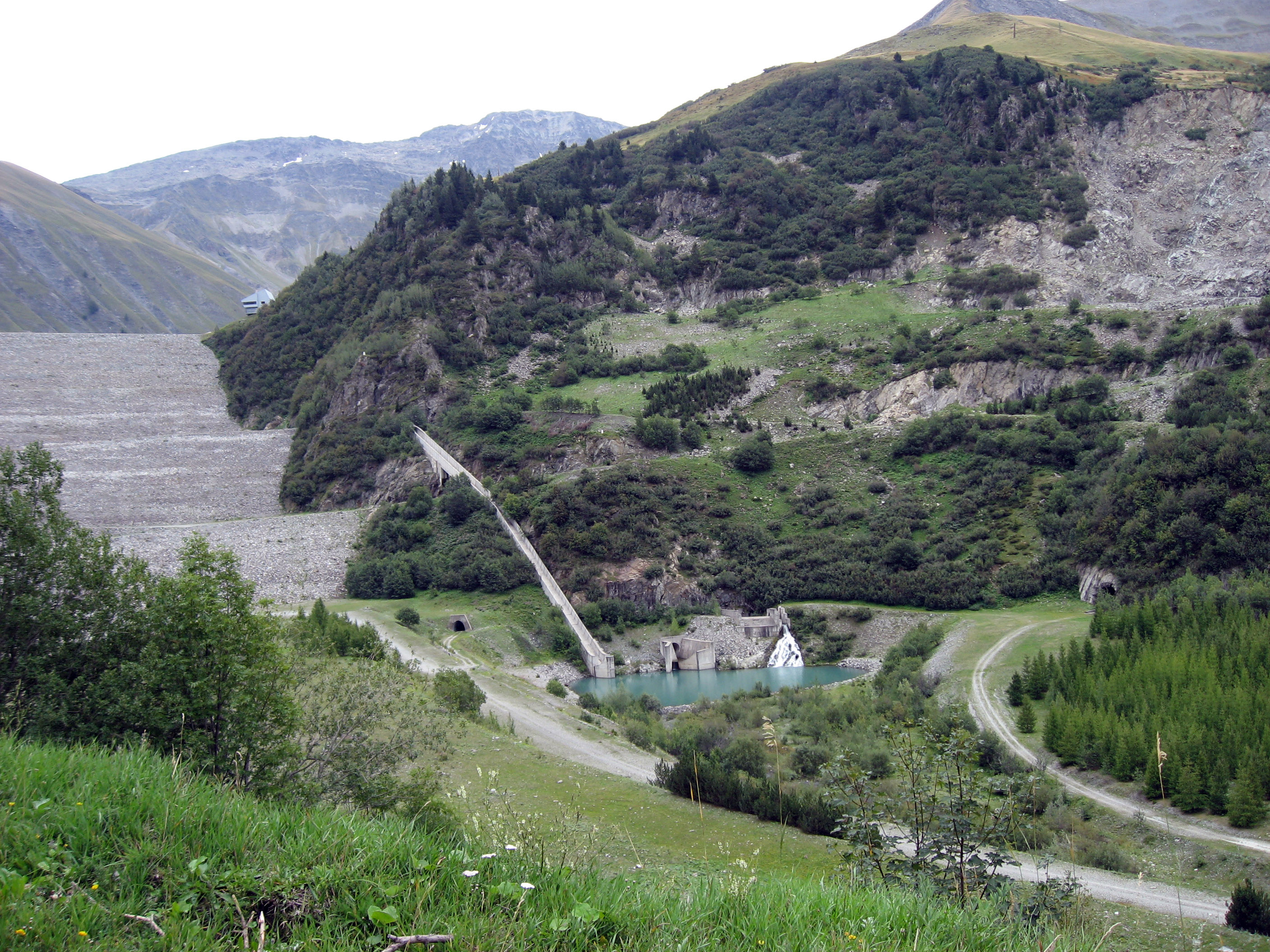
A lot going on in this photo, but the little building in the center left at the top of the dam is a museum about hydro stuff. If you know the name, email it to me!
These people came up and stopped near where we were stopped. This woman's Ducati developed a flat tire (they had repair kits along). I *think* that is a Ducati 999R or possibly 999S, either way it is the most beautiful and expensive motorcycle on this mountain today, these things go for about $30,000 new.
A little while onward, my buddy BrianB and I separated away from the group again and were exploring "Alpe-d'Huez", a little gravel single lane road maybe 30 miles long somewhere in France. In the picture below BrianB stops and poses for me, you can see the road we will end up on disappearing off into the center of the photo.
Yep, we're on the right road on our way to "Alpe D'Huez".
Kinda desolate, very very long, going basically nowhere. :-) Pretty, in a desolate kind of way.
This picture is pointed downwards, this is where we are going.
Later in the day, this is near St Cr�pin (south of Brian�on, France) on a little tiny road that snakes up into the hills.
At the hotel in the little town of Guillestre, France at the end of the day on Saturday, 9/2/06. Alex Walker in the picture below with his new cast. Alex broke his arm the day before playing in the yard (had nothing to do with motorcycles). The most important thing to Alex was that he could still wear his motorcycle riding jacket OVER the cast, which he did the following day.
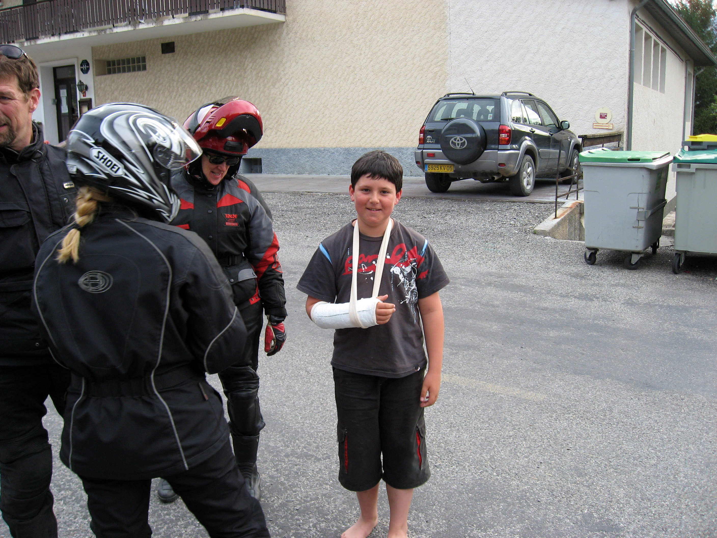
Here is a picture by BrianB of me (BrianW) talking with Alex.

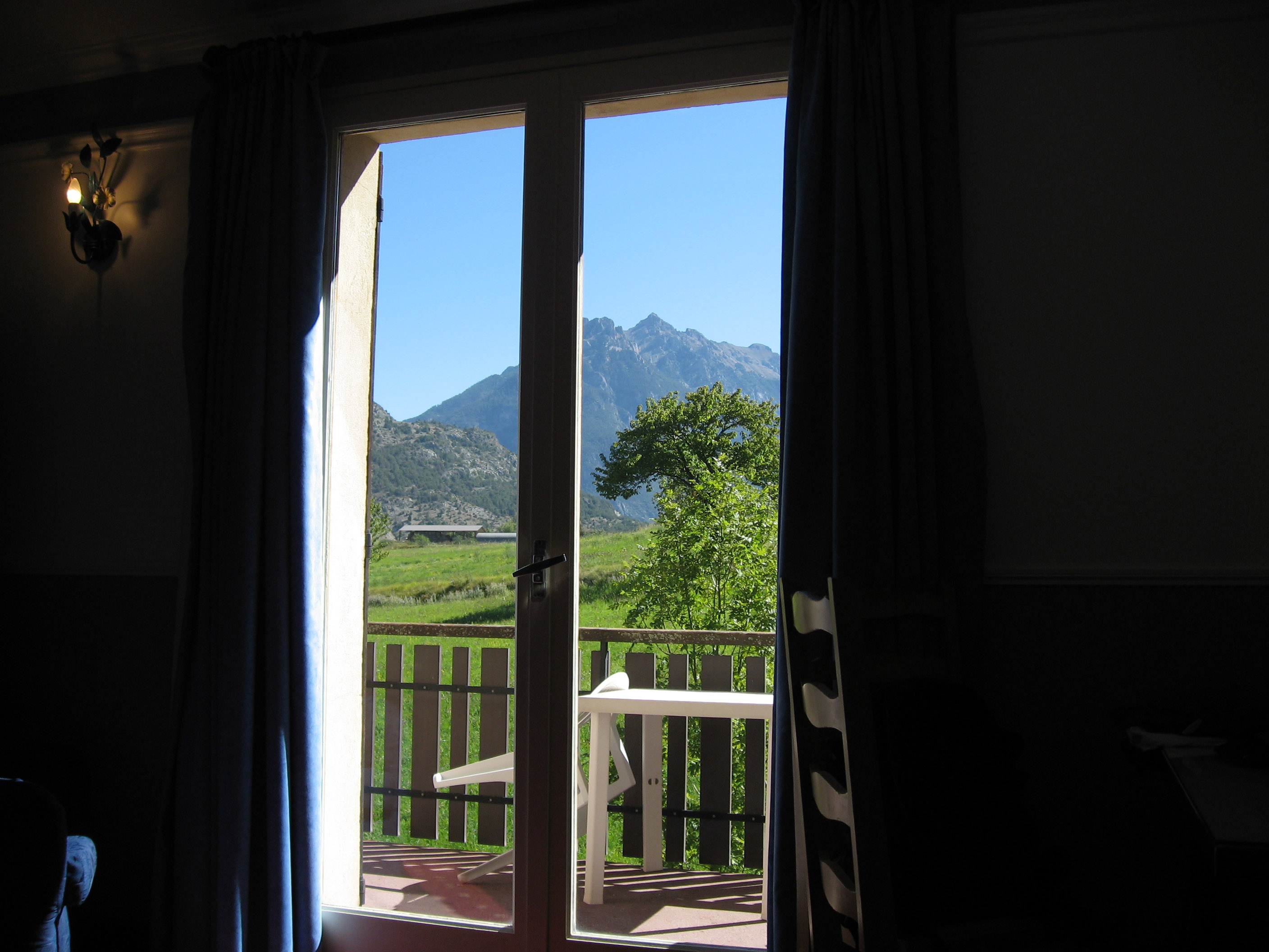
This picture was taken at the end of the day on 9/2/06 (Saturday) in Guillestre, France, from my hotel room looking out over the hills of France.
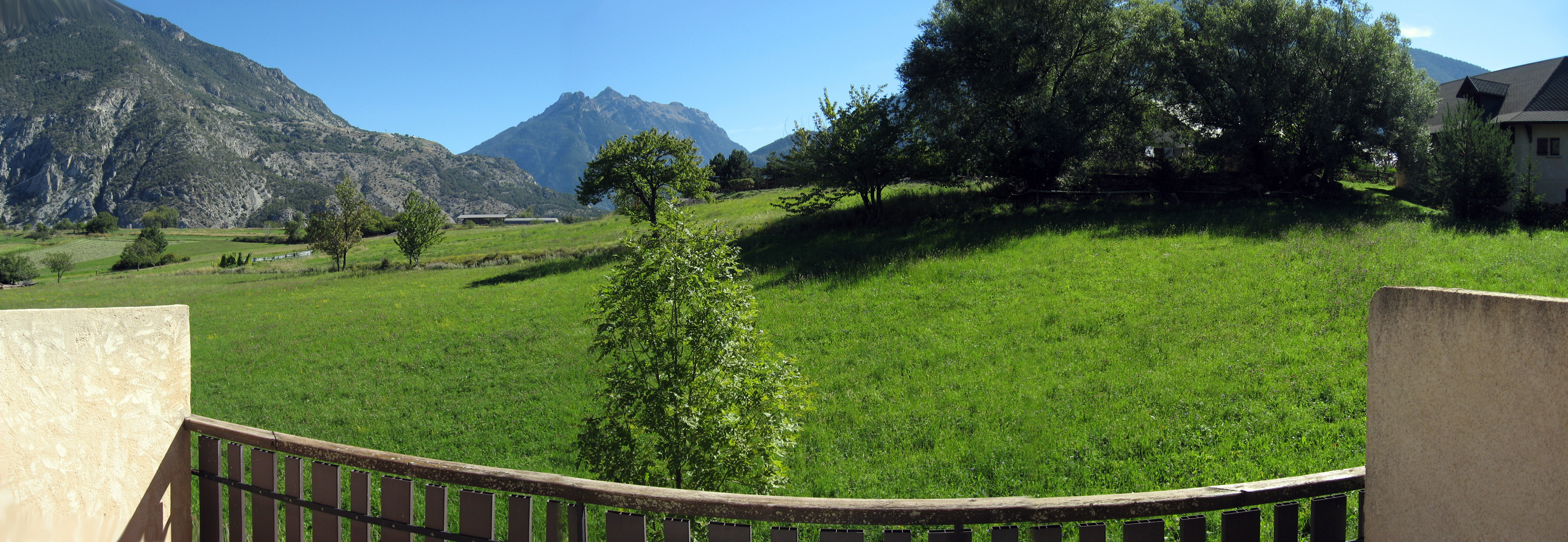
Stepping out onto the same balcony, here is a panorama from my private balcony of the hills outside of Guillestre, France.
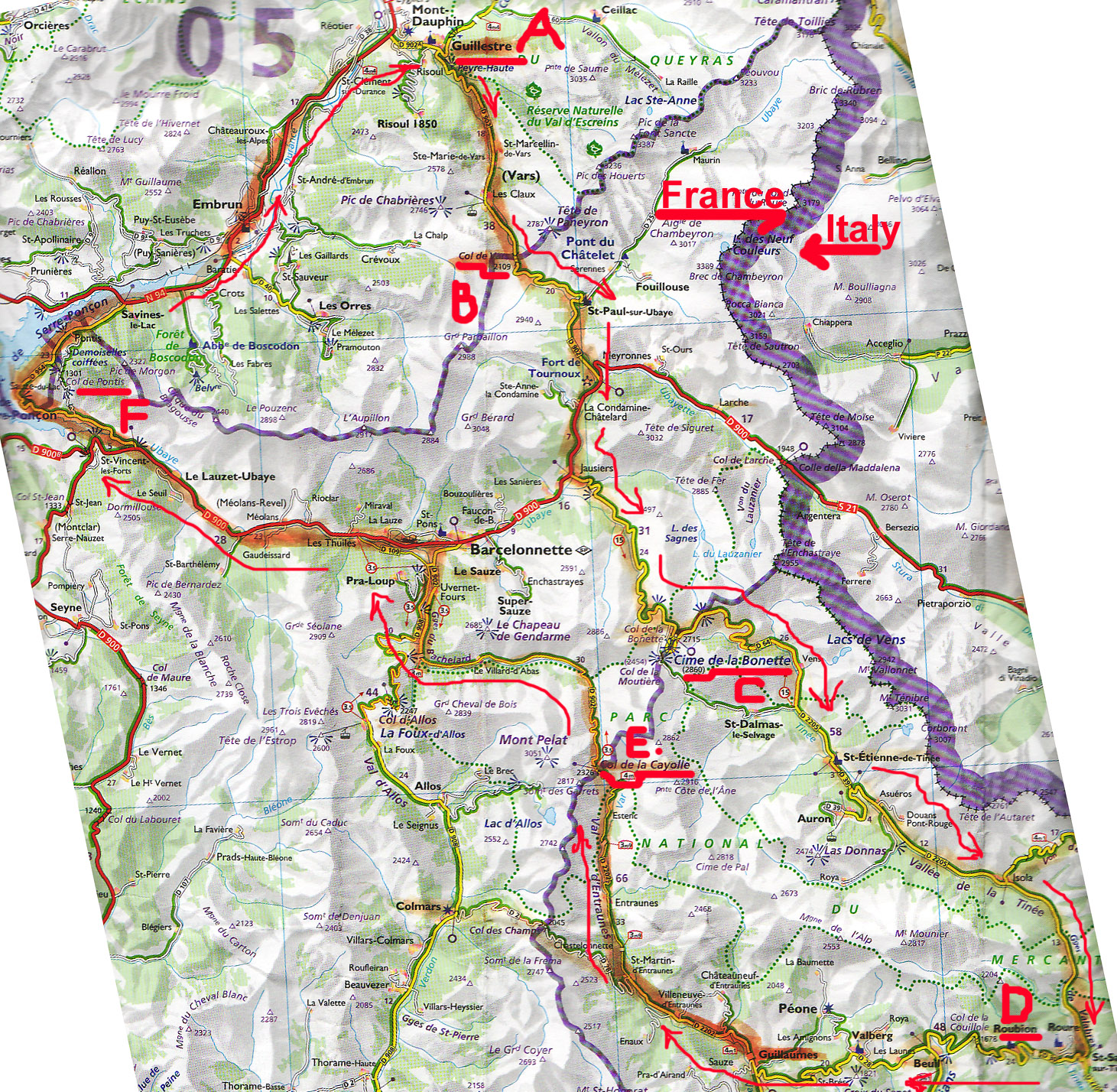
The day of Sunday, 9/3/06 was a "free day", but BrianB and Sarah Walker convinced me after sleeping in until noon to do a loop south of Guillestre, France. It was a wonderful day. Below is a map of our route, showing "A" where we started (and finished), "B" is "Col De Vars", "C" is "Col de la Bonette" which is the highest paved mountain pass anywhere in the Alps or Europe at 2802 meters, down to "D" which is "Roubion" a medieval town, up through "E" which is "Col de la Cayolle", then over a scenic TINY little road "F" which is "Col de Pontis", then back home. The loop took us around 10 hours which included all stops for pictures, cappuccinos, lunches, etc.
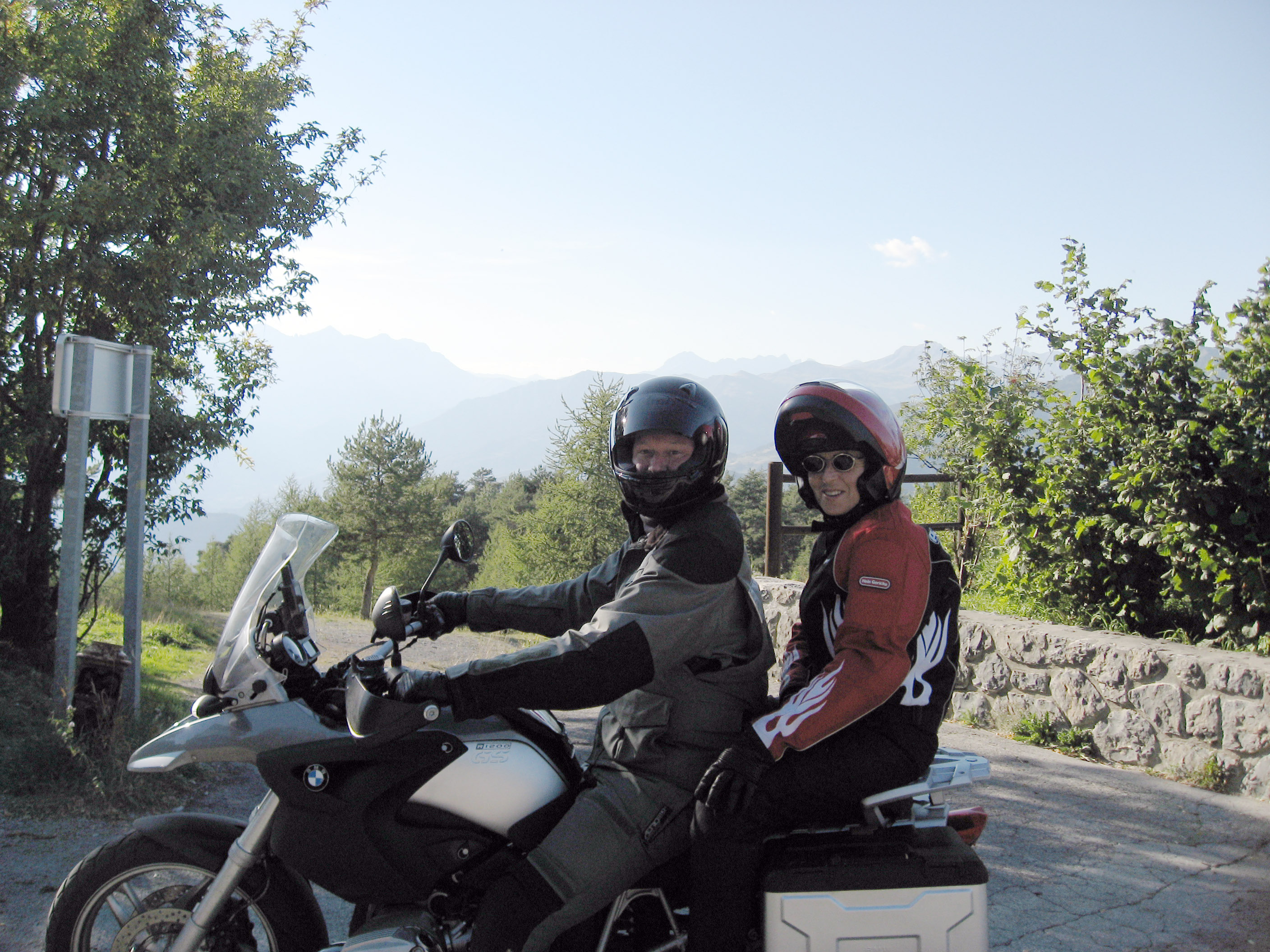
This is me (Brian Wilson, "brianw") with Sarah Walker on the back. My girlfriend's name is Sarah, so I called Sarah Walker "Virtual Sarah" for riding on the back of my bike this day.
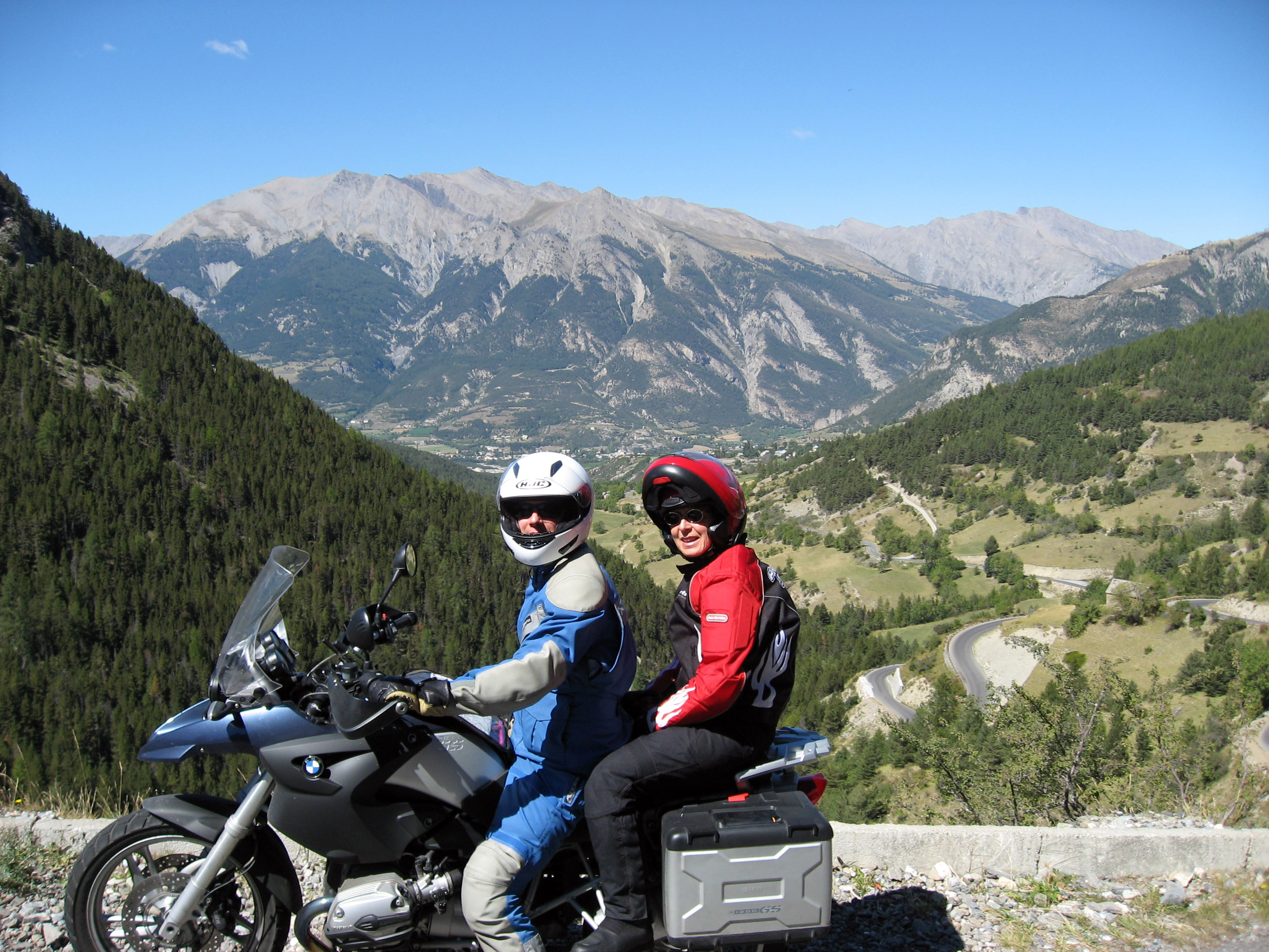
Early in the afternoon, here is BrianB with Sarah on the back. You can see the road we just climbed up below them to the right. We are climbing up to Col de Vars here (point "B" on the map above).
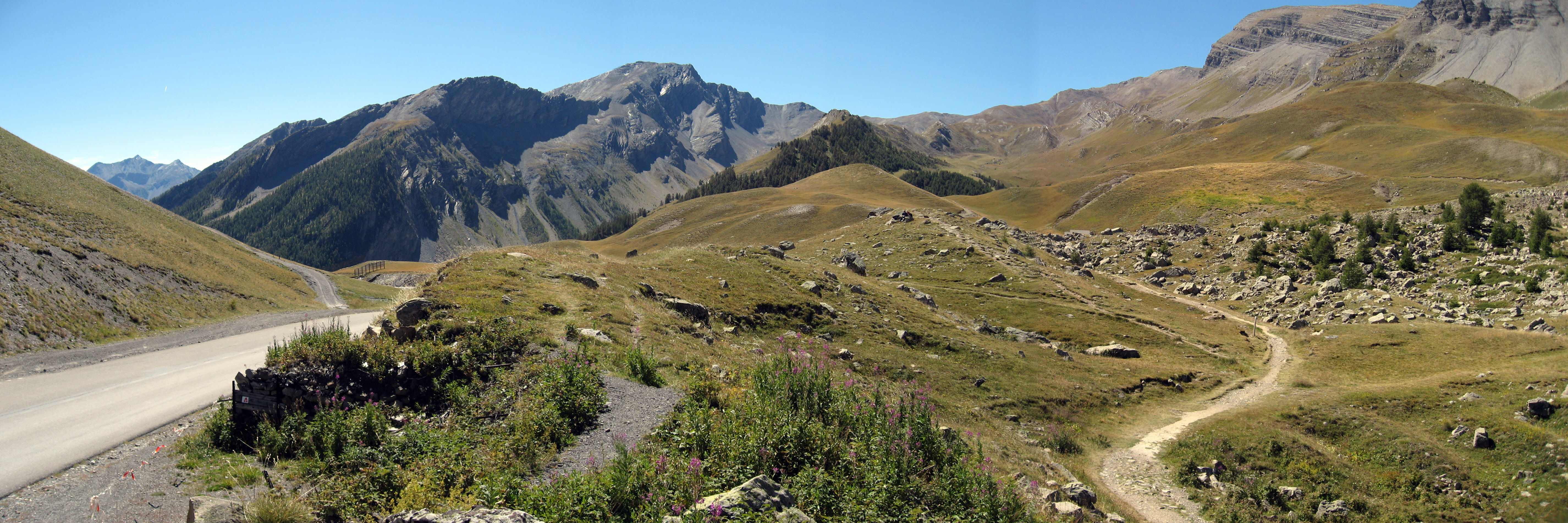
Here is a picture of "Col de Vars", France, a mountain pass in France.
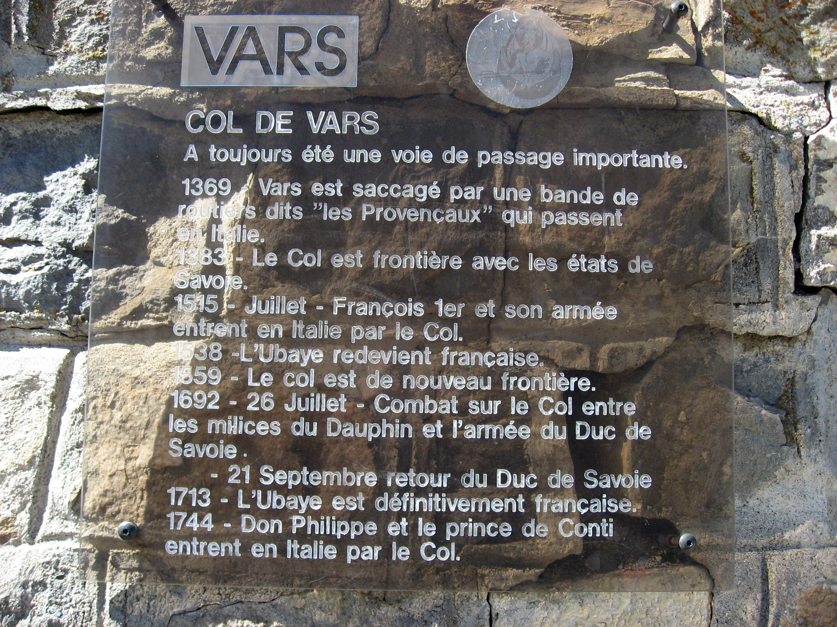
A sign documenting (in French) the history of this place.
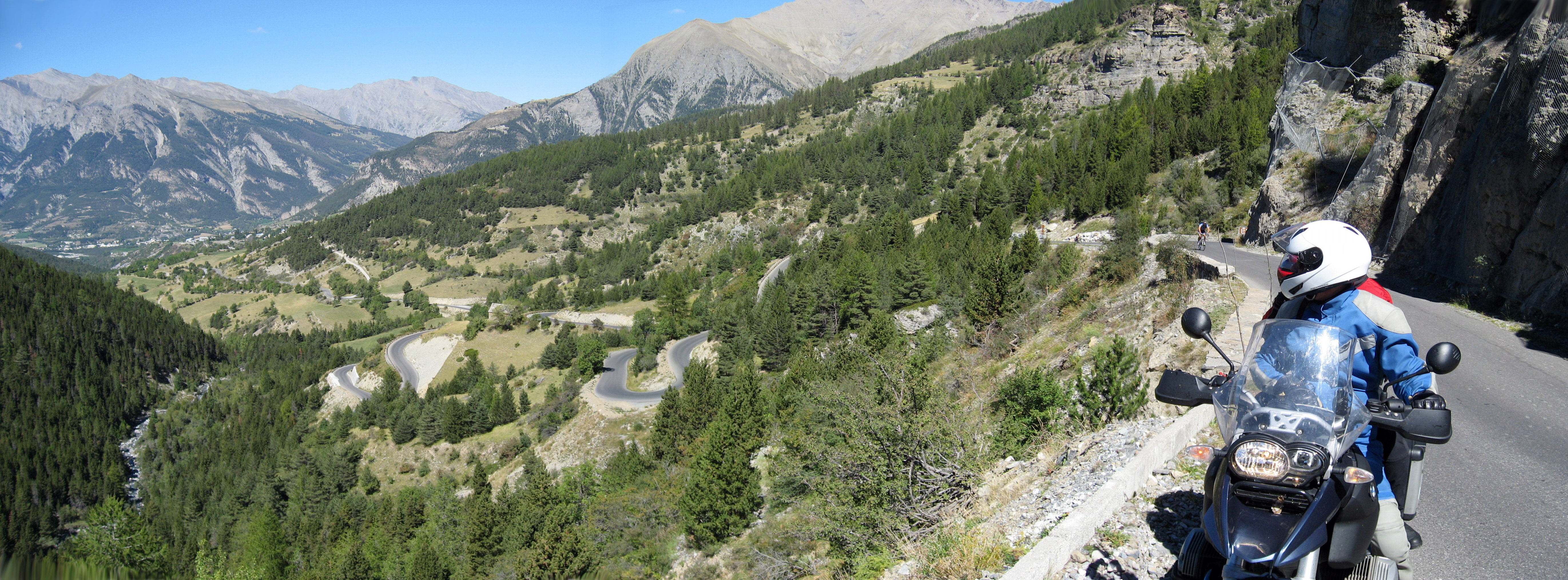
The road climbing up towards Col de la Bonette. That's BrianB on the right looking over the road we just came up.
The final approach climbing up towards Col de la Bonette, we came upon these sheep crossing the road, that's BrianB and Sarah up ahead of me pushing their way through the sheep.
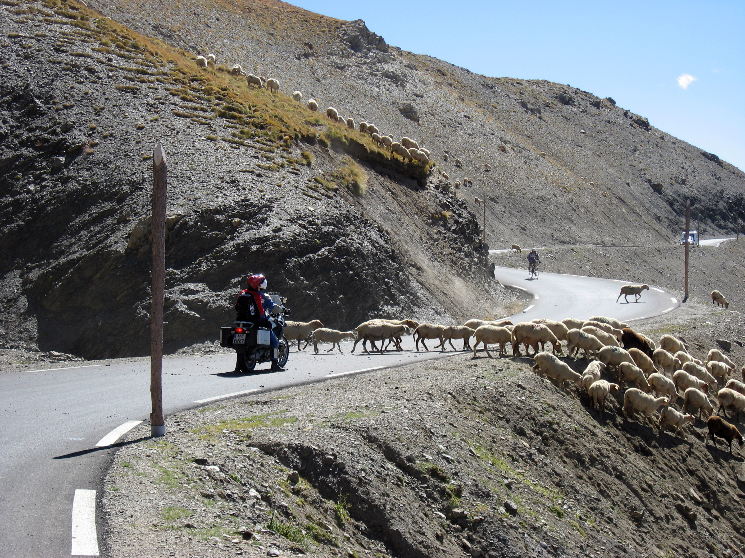
BrianB and Sarah passing through the sheep.
Up almost to Col de la Bonette, France, we stopped at this old military bunker in the side of the hill. Notice the pill box up higher on the mountain. We walked inside this open maze of tunnels that leads from the door down below to the pill box up above, and it's an EXTENSIVE tunnel system, all abandoned. The rooms inside look like they could house troups for weeks or months.
A close up of the entrance we walked inside.
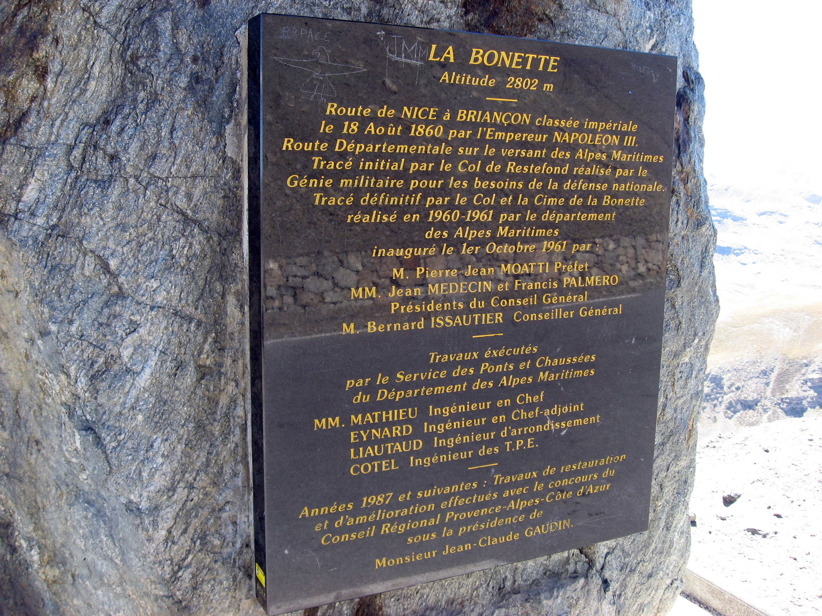
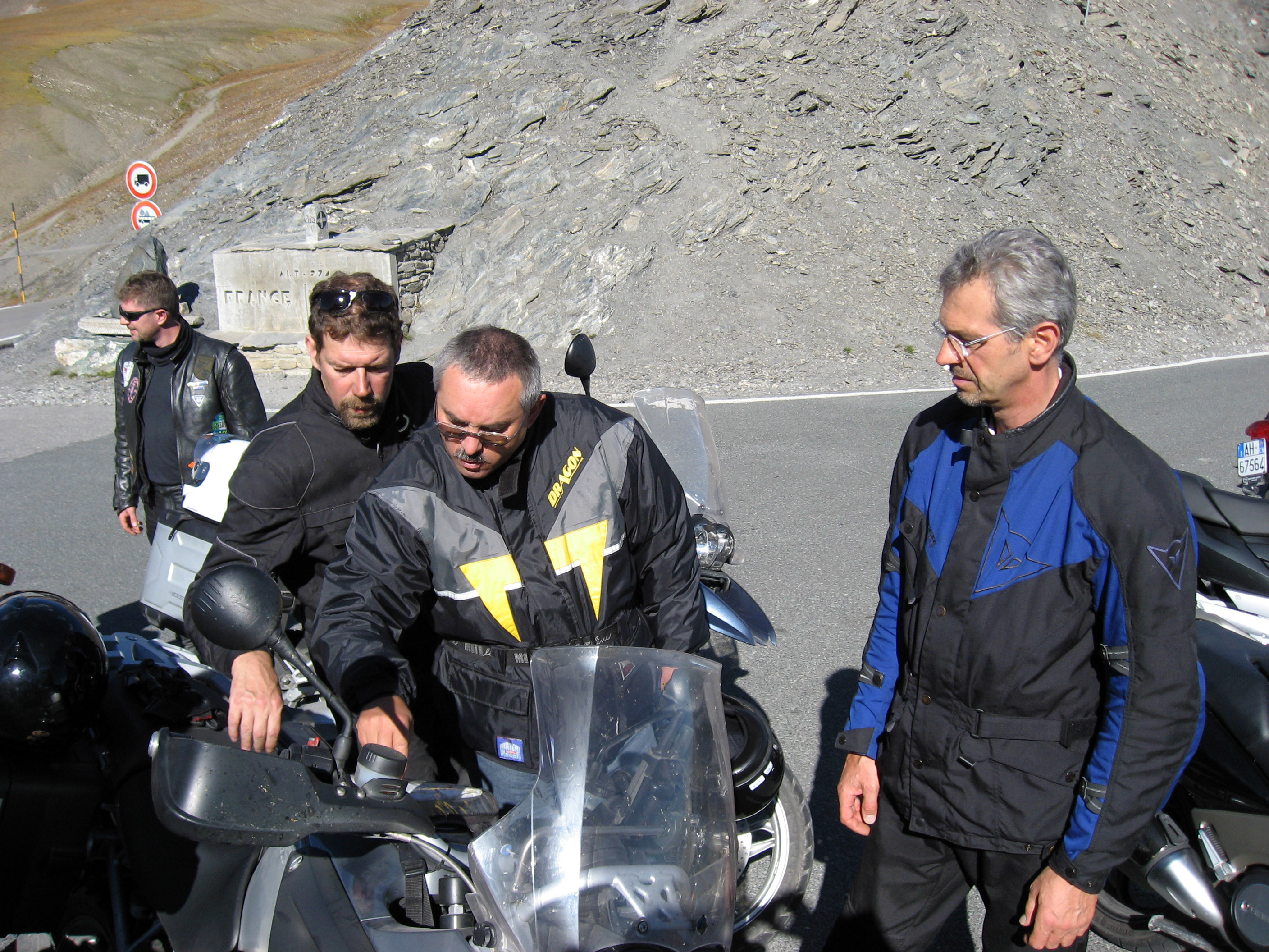
Here we are in a quick stop at Col de la Bonette, the highest paved mountain pass anywhere in Europe at 2802 meters. None of these other motorcycles are from our tour, just random Swiss, German, Italian, and French motorcyclists out for a drive.
A very clear explanation of "La Bonette", unfortunately I do not speak French so I have no idea what any of this means. :-)
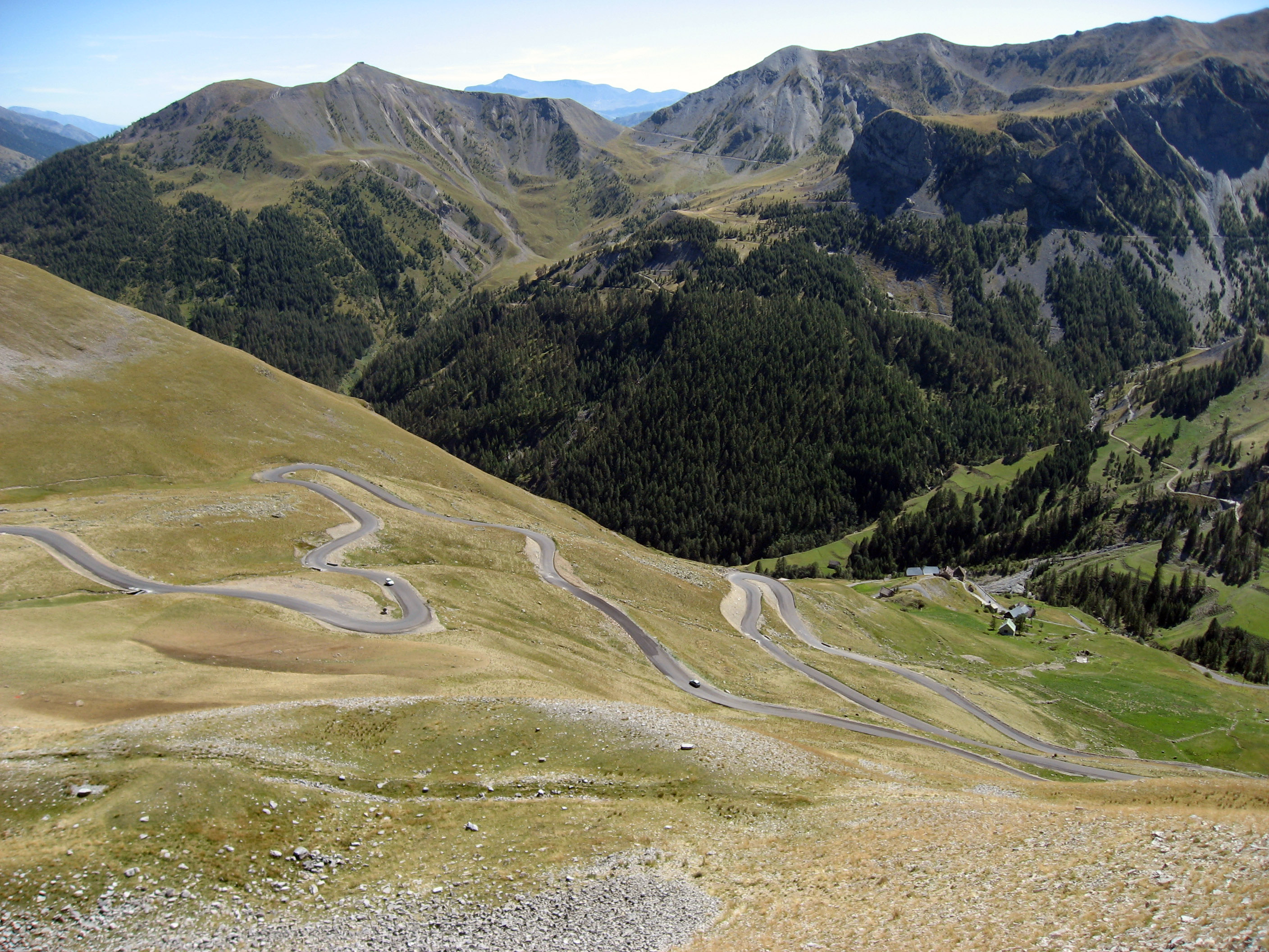
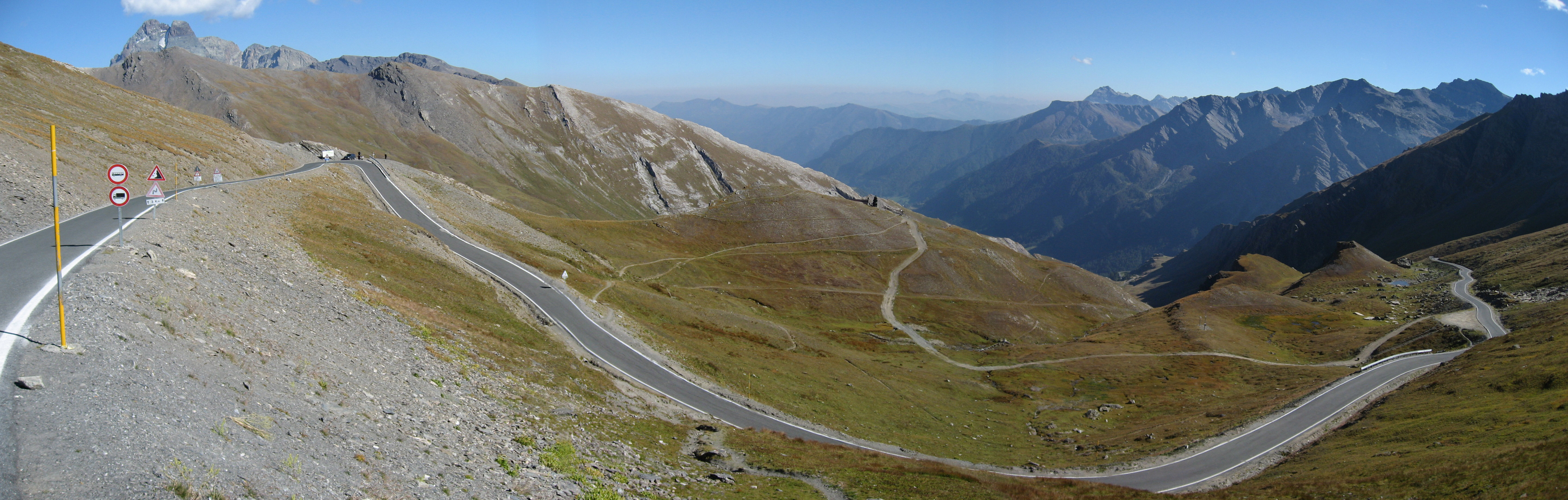
Going down the other side, you can see the road we will be dropping down into the valley on off in the distance.
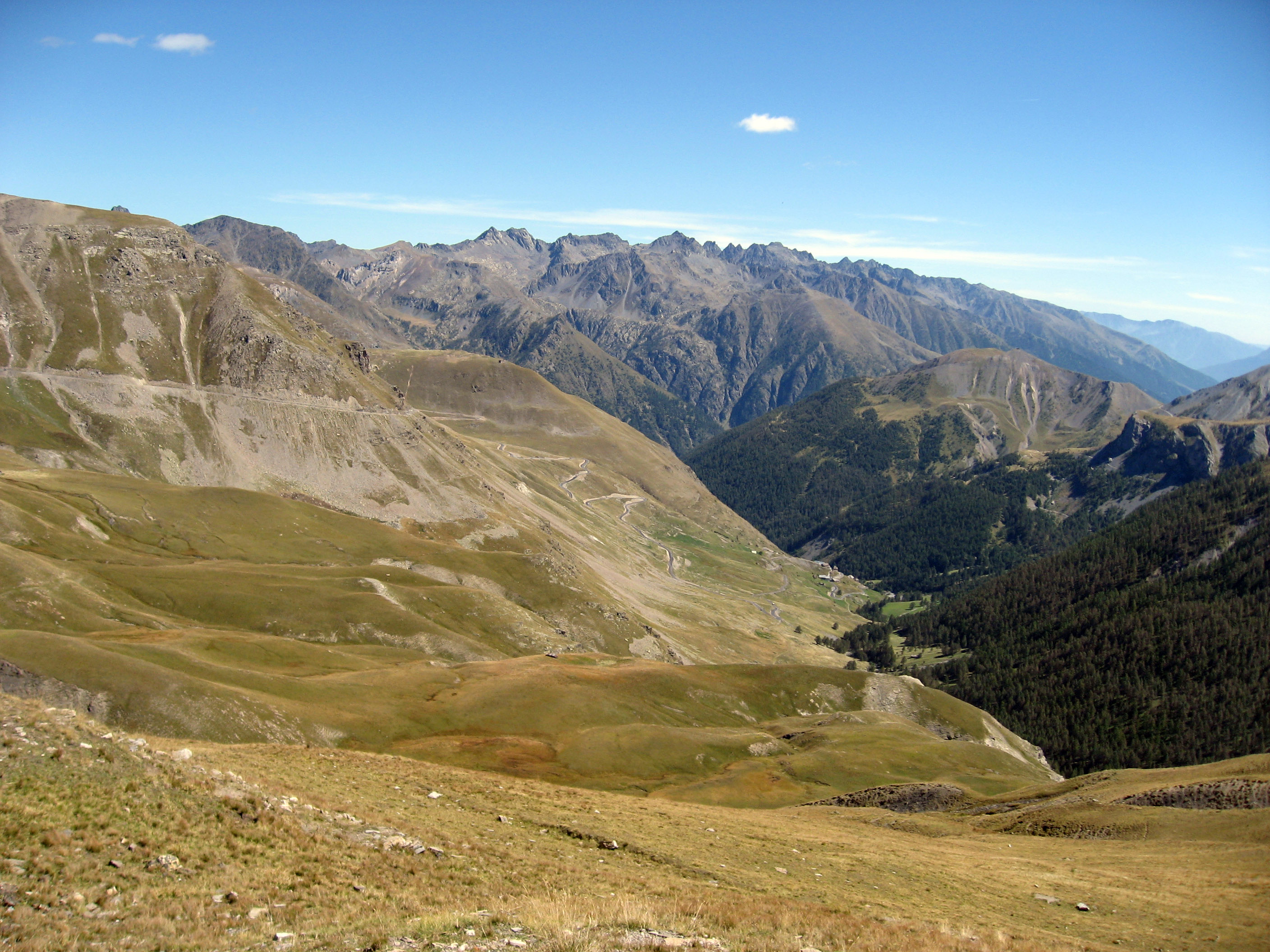
The far side (southern side) of Col de la Bonette, France.
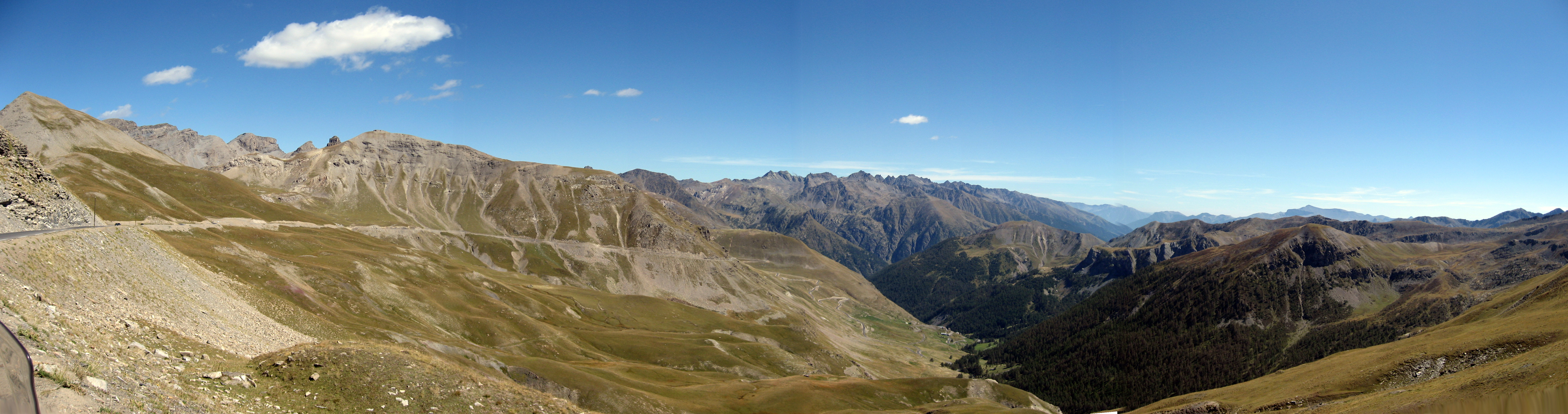
This is the road we are about to ride down on.
We passed through this little empty, unoccupied set of uniform houses in various states of disrepair. It looks like a military post, kind of old.
In the valley floor, we stop for a cappuccino break here.
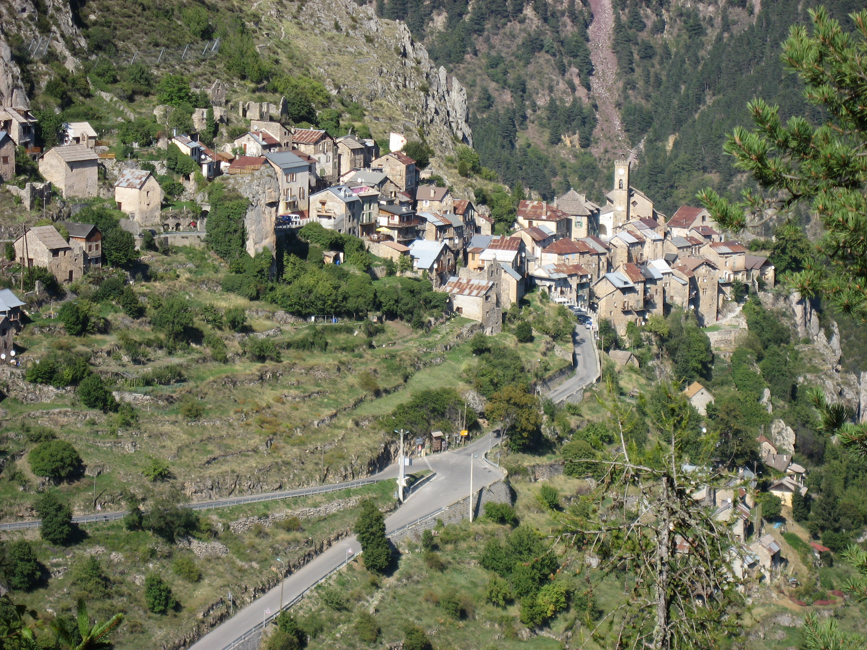
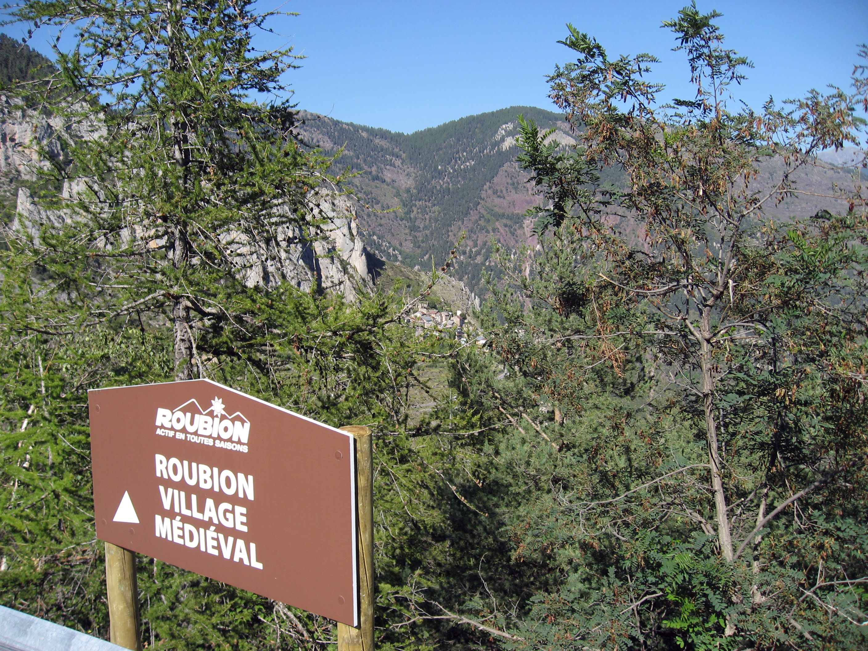
We came to "Roubion" France, which is a medieval (12th century) village perched on a ridiculously steep cliff with amazing views in the middle of nowhere. I found this website which describes Roubion France.
Looking up at Roubion, France trying to capture where and what it is.
This next photo looks DOWN on Roubion, France to try to show where and what it is. We took this 10 minutes later driving along after leaving the spot from the photo above.
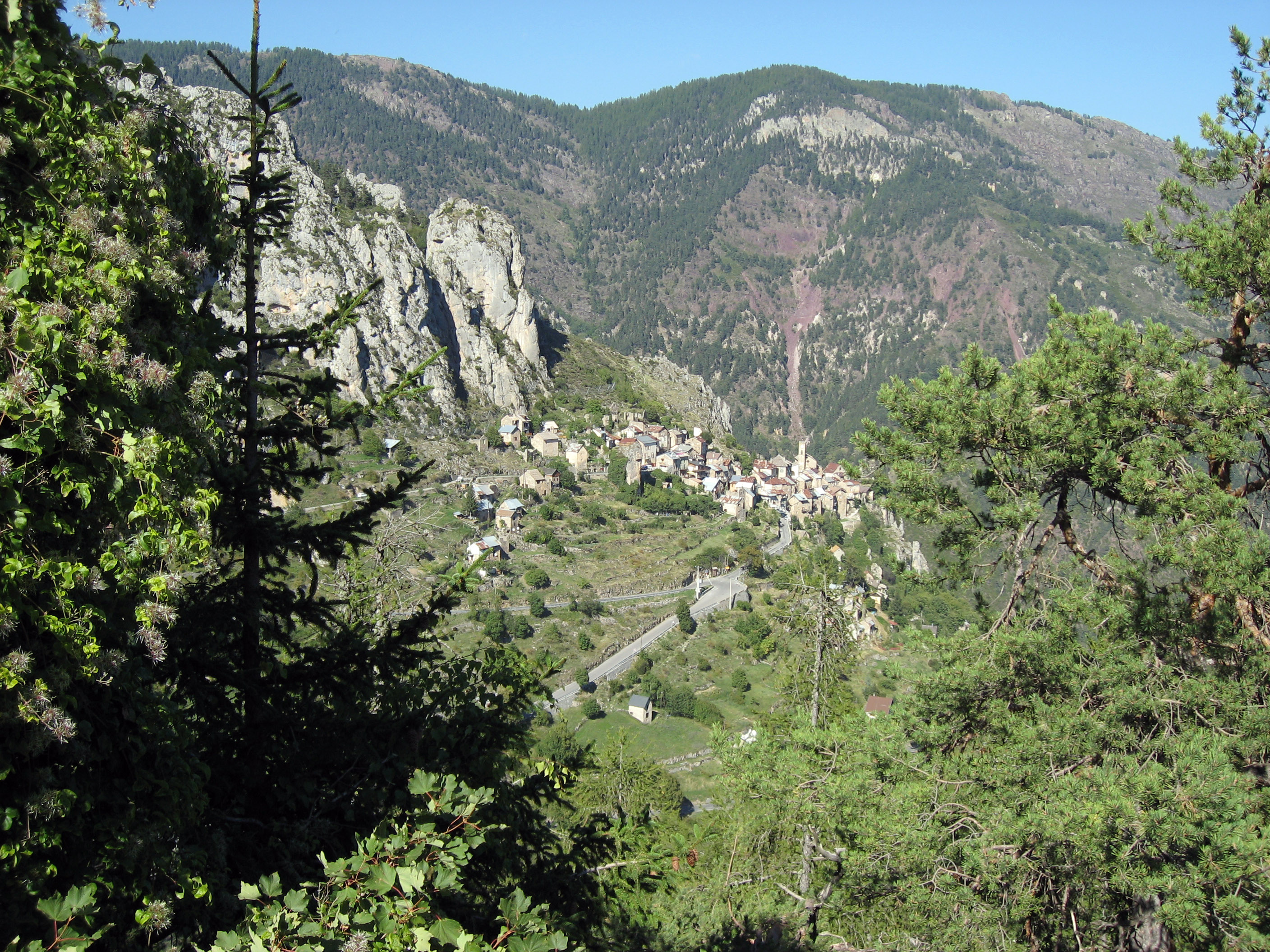
You can see Roubion, France nestled in the very very center of the photo below.
Same shot, a little more zoom.
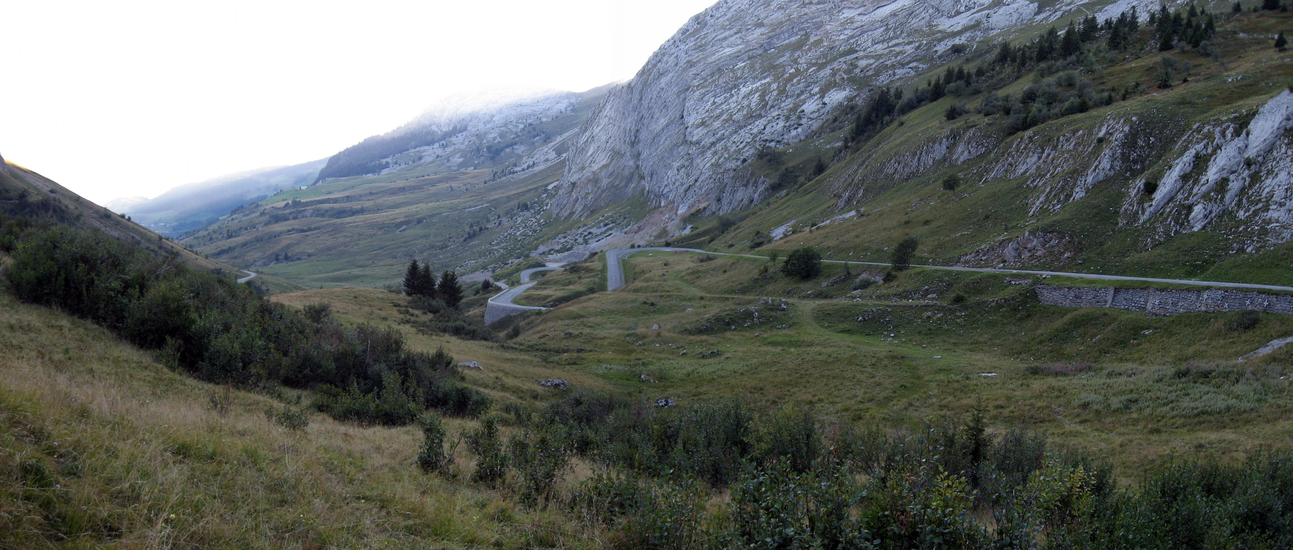
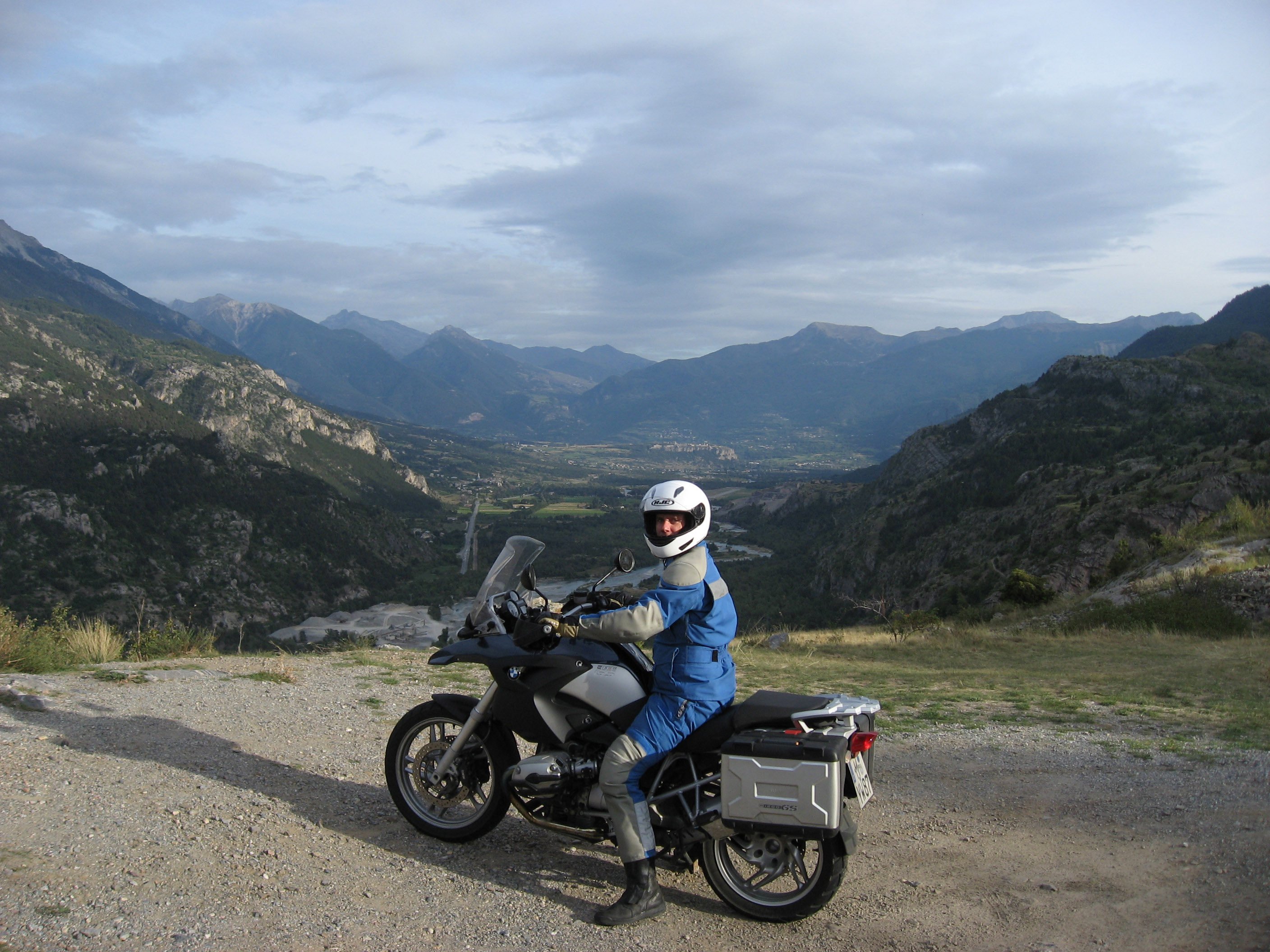
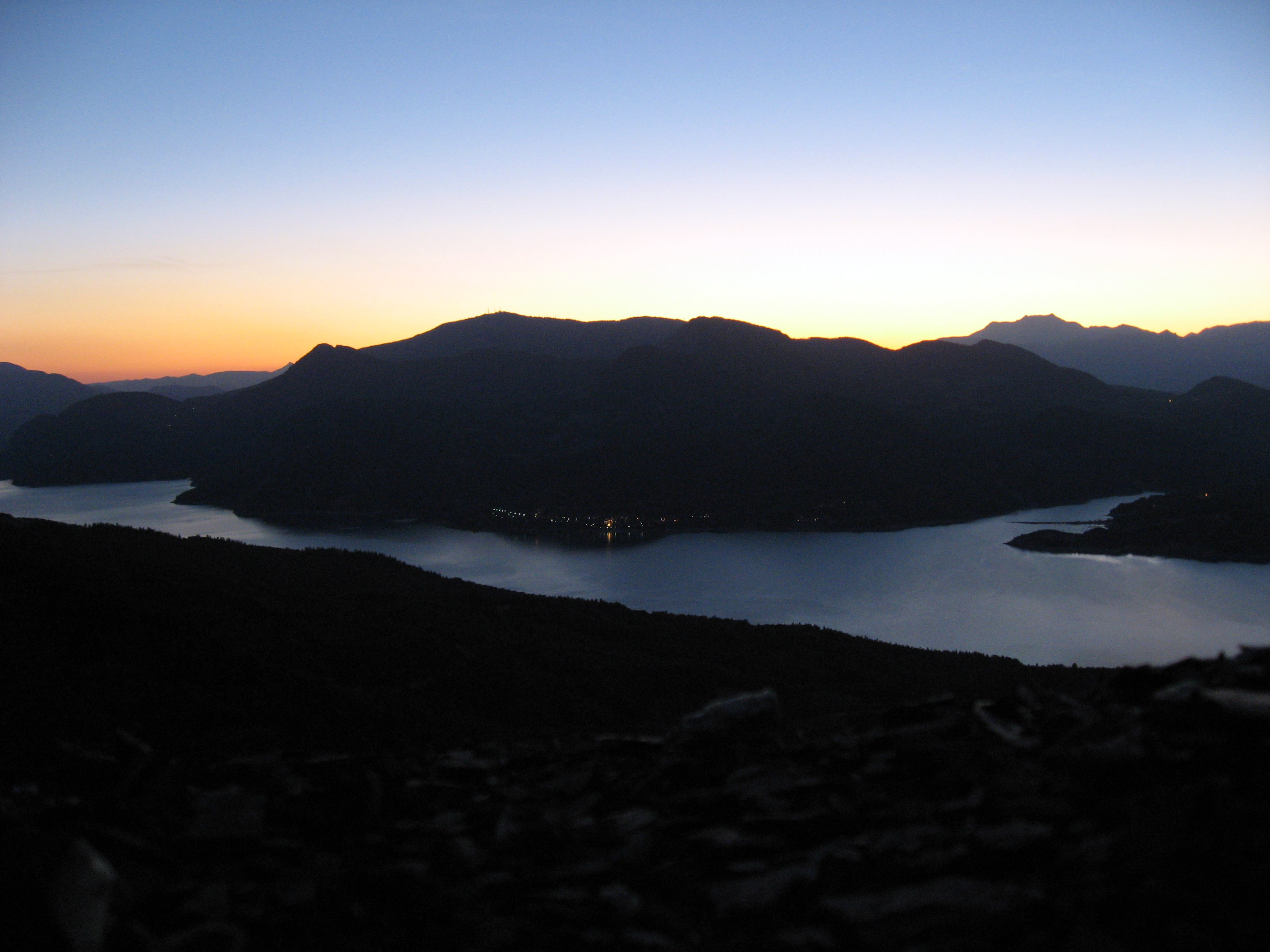
This is "Col de Pontis", a tiny little road above the lake "Lac de Serre-Pon�on". This is marked on the map above as red letter "F". Since we got a late start, we got caught out at dusk as the sun went down, but we are only another 20 minutes from home when we took the photo below.
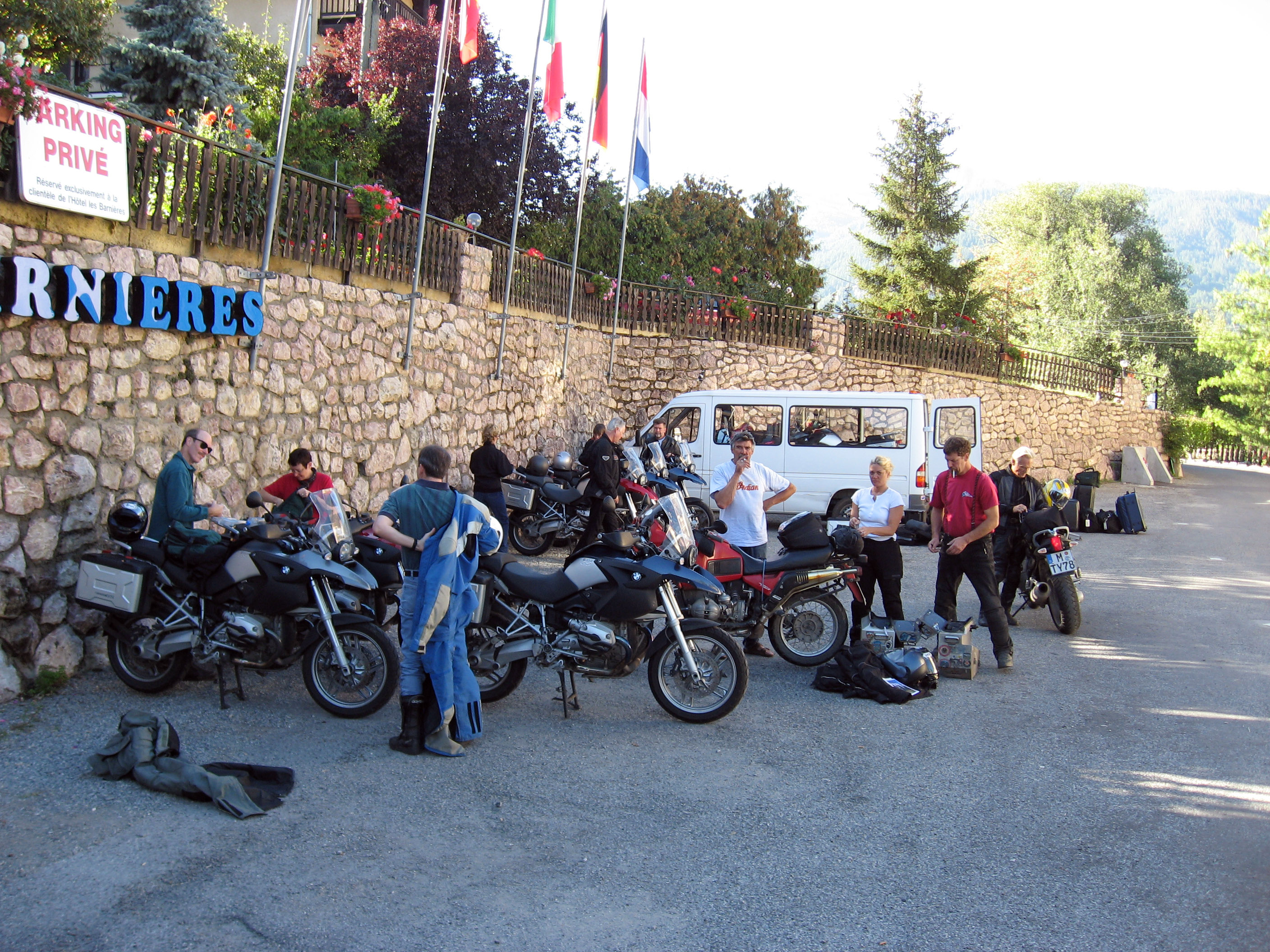
The photo below was taken the morning of Monday, 9/4/06 in Guillestre, France. This is a very normal morning scene on the tour, we drop off our luggage by the white van (you can see a small pile in the far back right), and gear up for a great day of motorcycling. The white van will take our luggage to the next hotel, while we pack only enough gear for a comfortable day ride (sweaters, different gloves, camera, etc). A few minutes after this picture was taken, we will have all split up into smaller groups of 1, 2, or 3 motorcycles. This day BrianB and myself (BrianW) hooked up with the tour guide Rob Beach to scout a set of roads not marked on the maps, then run a few mountain passes. So we didn't see anyone else from the group for the rest of the day until we got into the next hotel around 8pm.
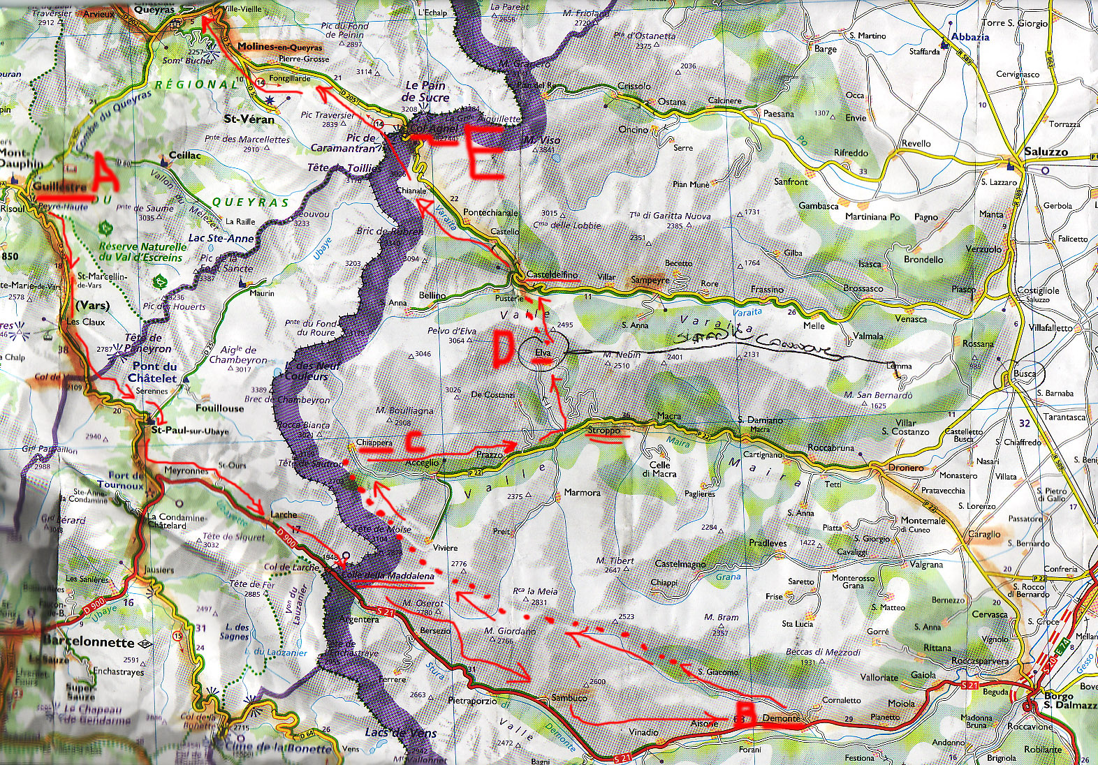
The map below shows our approximate route (and how we left the marked roads). Click on the map for a larger, more readable version. We started the day at "A" which is Guillestre, France. We crossed over into Italy at Colle della Maddalena. We turned left (North) at the point marked "B" near Demonte, Italy. We drove for about 2 hours on a gravel road not marked on the map to pop out at a "Agriturismo" (place for tourists to eat) near Chiappera marked "C" on the map below. (NOT TOTALLY SURE it was near Chiappera!! If you know better, email me!) Ripped down to turn left (North) again at Stroppo, up to Elva marked "D" on the map below, then through unmarked roads to Sampeyre or Casteldelfino (not sure which), then up through Col Agnel marked "E" on the map, then Northwest up through a couple more mountain passes to our hotel in Valloire, France. We ran into some Italian motorcyclists later in the day who told Rob about the road that is hand-written on the map to the East of Elva (mark "D"). This hand marked road goes along the ridges of the mountains, claim the Italians. Rob would like to explore that next time he comes through this way. (Update on 12/29/06: Rob writes "...it was the way Napoleon took his troops and cannon into Italy. ... Not on the Garmin maps, but it is on some Topo maps and an old Alpine book I found.")
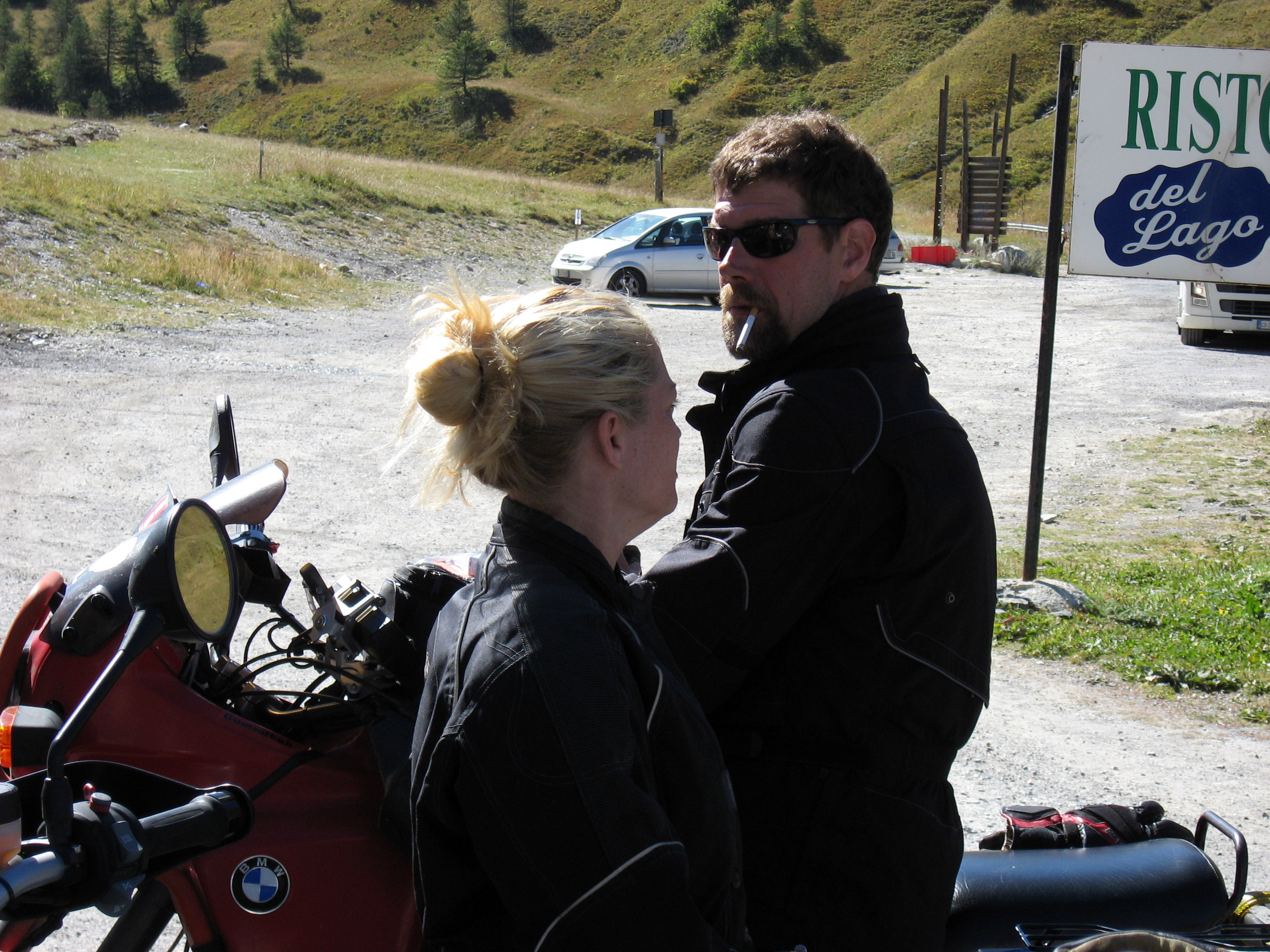
An hour into the day, and we pass over the border from France into Italy near Colle della Maddalena, so we stop for what Rob calls "REAL Coffee" (from Italy :-) and a cigarette.
Soon after turning north at Demonte, Italy (marked "B" on the map above) we are on this tiny little paved road. That's BrianB on the left, and Rob and Gretchen on the right.
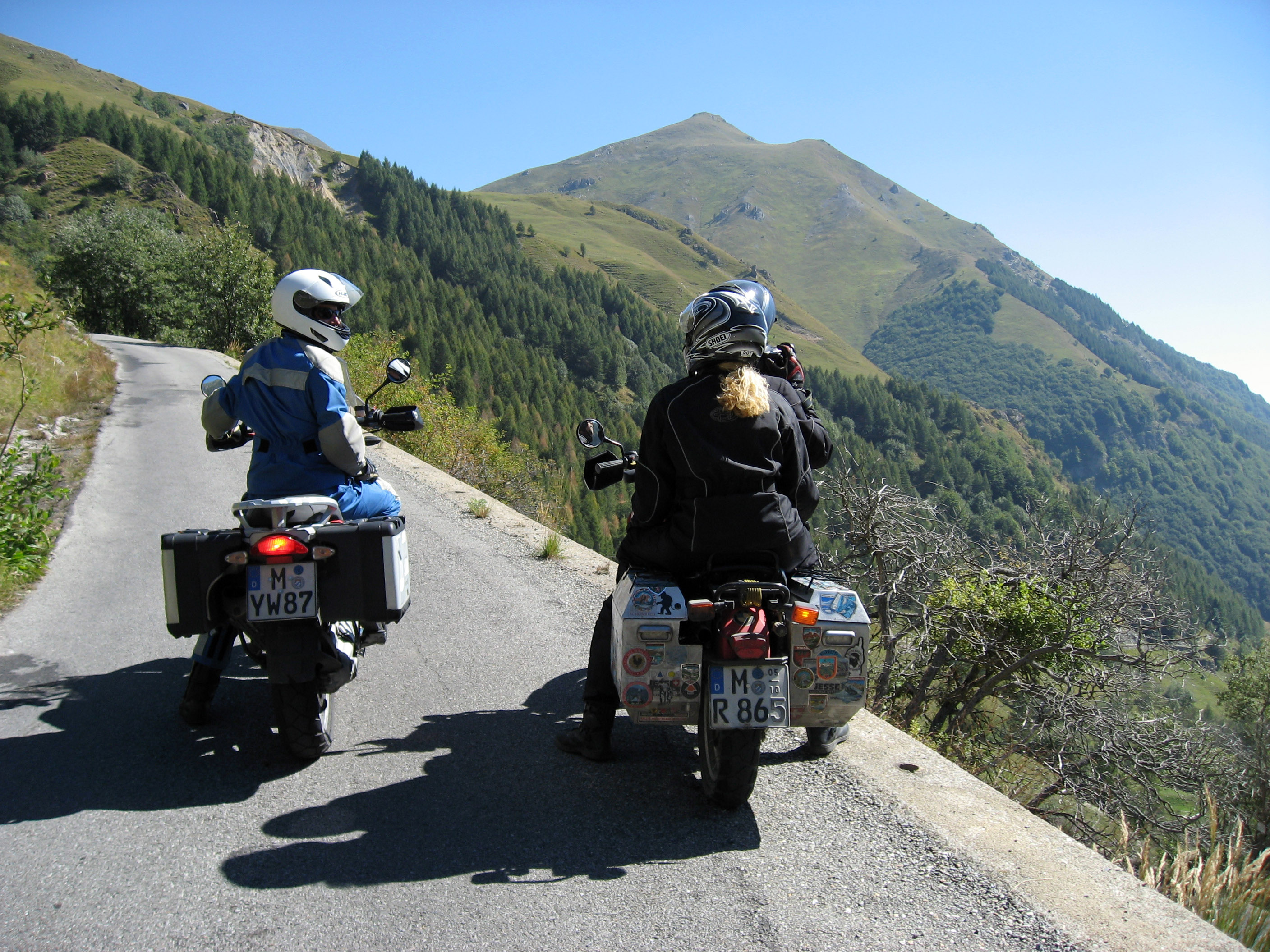
Same spot, panorama so you can see the drop off (WITH NO GUARD RAIL!!) and the size of this two way road. We met trucks coming the other way on this road later!
Below is the point at which we headed straight into the distance on that road which is gravel, and unmarked on the map. We spent the next two hours on this gravel road trying to find our way through from point "B" to point "C" on the map above (the dotted red line).
We spread out on this gravel road so we didn't eat the dust from the motorcycle ahead of us. The red arrow ahead points at Rob's lead motorcycle.
Zoomed in shot from the same location.
The picture below shows the gravel road and what it is like. Pretty well maintained, but slow going (5 or 10 mph maximum). No guard rail, and no other people or cars for miles and miles.
Stop for a break, it's warm so we all stripped down out of our safety gear. Gretchen on the left, BrianB behind to the right.
After 2 hours of riding through the gravel, about 3 minutes before we popped out onto the paved area, I look down at BrianB below me around the next switchback and his motorcycle is dropped over on its side! Like a good friend, I didn't help, I just took pictures. :-) He had come to a stop to let an oncoming car pass, and his back wheel slid sideways in some sand, nothing hurt.
Just zoomed in to get that picture of the 2006 BMW R1200GS on it's side in the gravel. :-)
Around 2:15pm we finally popped out at this "Agriturismo" (place for tourists to eat) I *think* near point "C" on the map above, which is near Chiappera, Italy. They served us a wonderful multiple course meal of meat, pasta, cheese, and breads.
A picture of our motorcycles parked outside of the Agriturismo. Right at this location the gravel road turned into nice pavement and marked clearly on the map.
I'm not totally clear where this point is pictured below. We were at a high point somewhere around north of Elva (marked "D" on the map). That's Rob and Gretchen on the left, with "The Red Devil" (1989 BMW GS) in the foreground.

Another pass later, and we reach "Colle Dell'Agnello" pictured below. This is the mountain pass (marked as point "E" on the map above) that we passed from Italy back into France.
Rob and Gretchen on "The Red Devil" motorcycle on the border between Italy and France.
This picture is back down the Italian side of Colle Dell'Agnello, this is the road we just drove up.
We actually had coffee at the same coffee stop (near Colle della Maddalena) as these two Italian motorcyclists 6 hours earlier than this picture was taken. When we ran into them late in the day, Rob compared notes with them on how they got here. They spoke almost no English, and we spoke even less Italian, but we got the information across and everyone was very friendly and relaxed about the slight communication barrier. It is really nice that people in Europe expect to run into people that do not speak the same language, and it doesn't put them off -> these guys were very relaxed about communicating with gestures, pointing to maps, and sharing in our common enthusiasm for small roads and motorcycling. Sadly I don't know of many places in the United States where you would see people so relaxed in the face of such a language barrier.
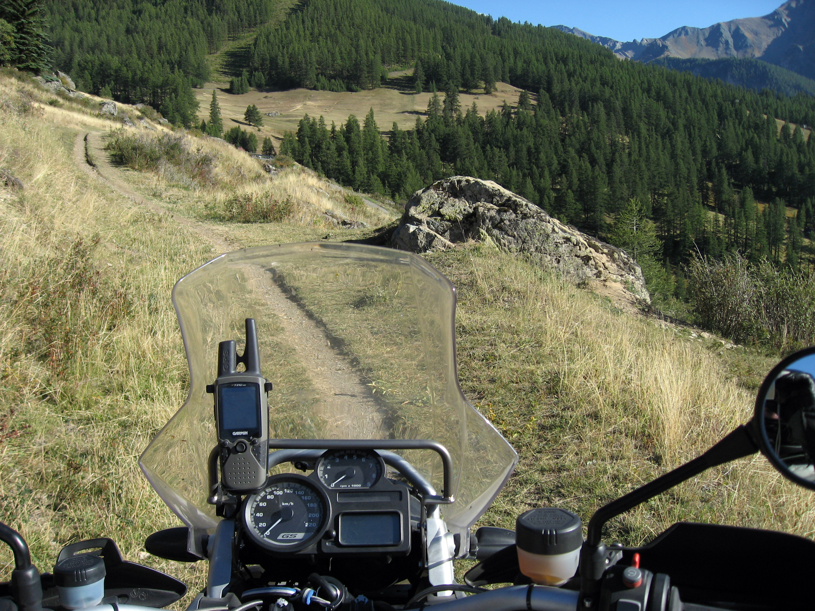
An hour down the road, and I was leading, and I took one wrong turn and the road got smaller and smaller until I led our group onto the SINGLE WHEEL DIRT PATH through France seen below. Yep, one wrong turn. :-) We forged ahead and dropped down onto the correct road we should have been on.
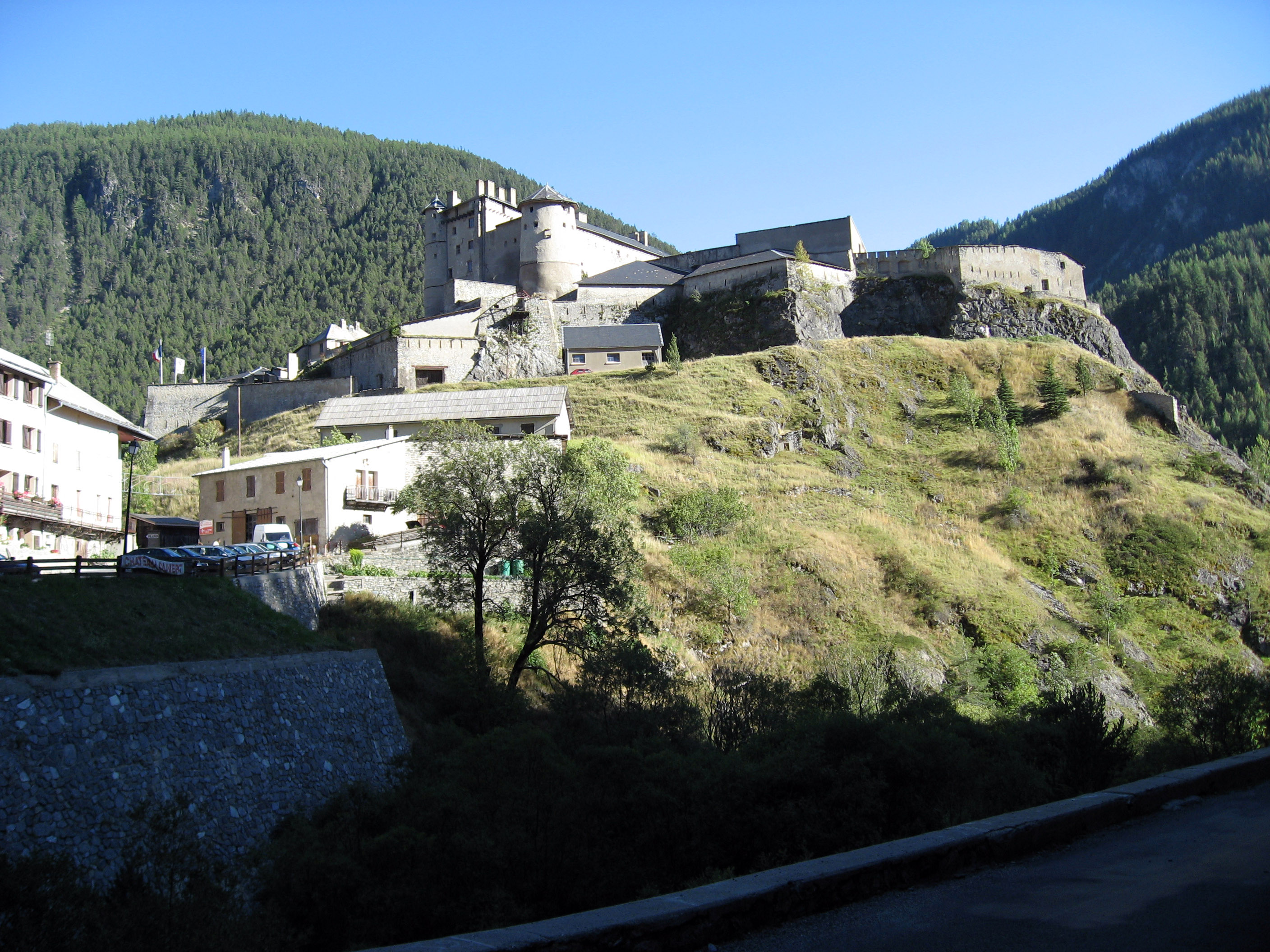
A completely random castle, don't have any clue where or what it's name is.
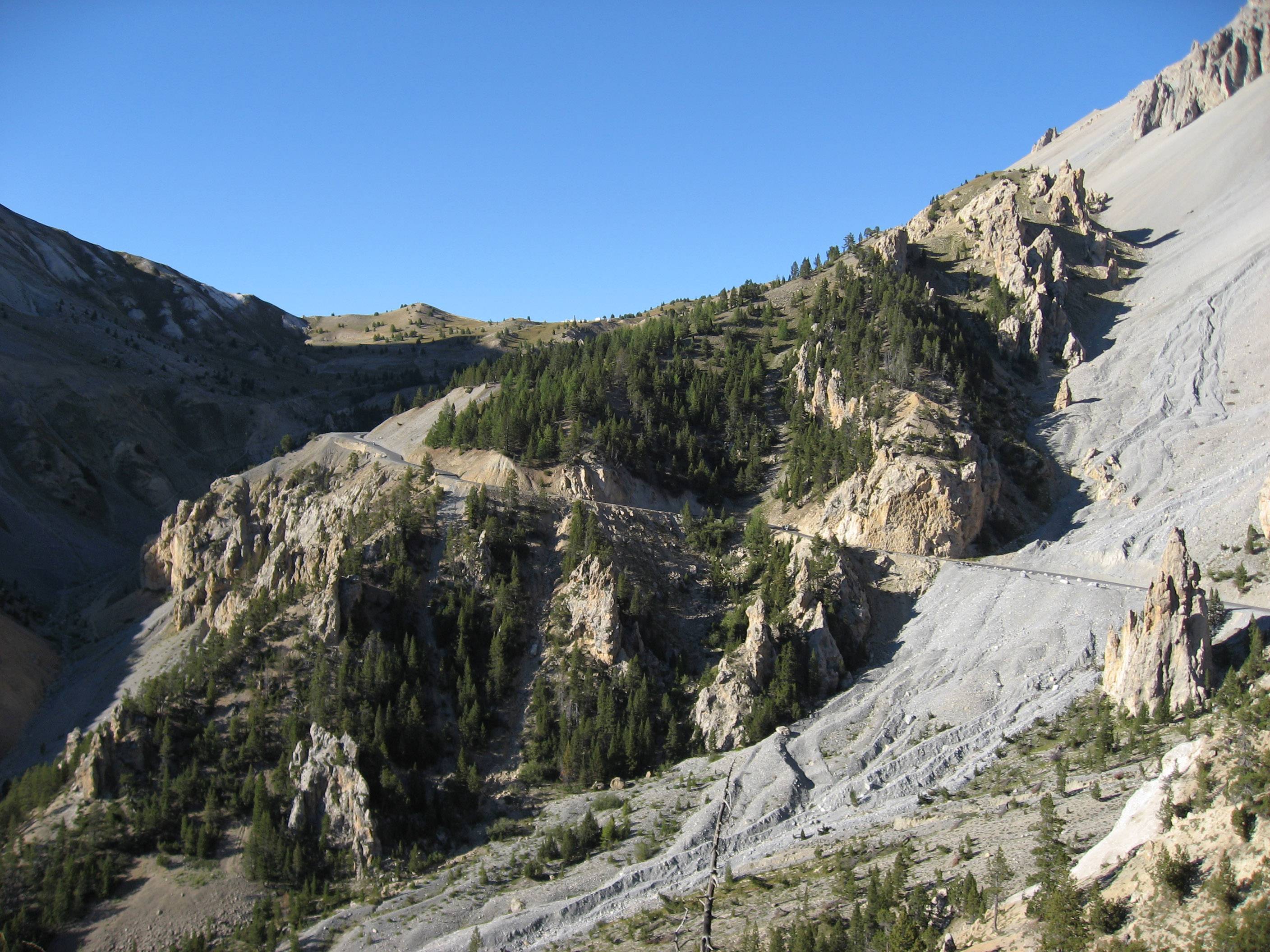
We started climbing up toward Col d'Izoard, France on this road.
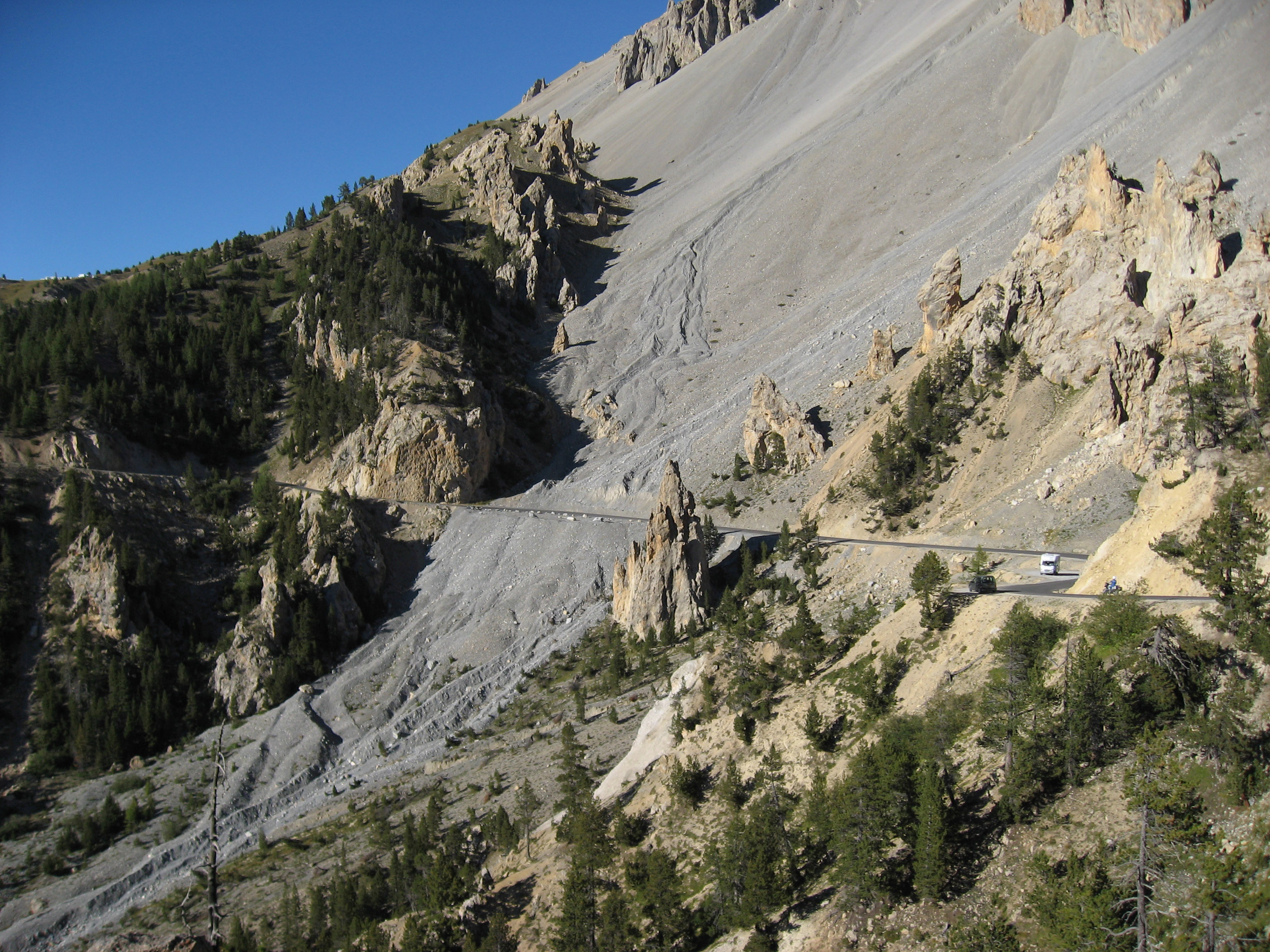
Same road. If you squint I think that's BrianB as the blue speck in the very very center of the photo on the road. (Click on the picture to get a much much larger version.)
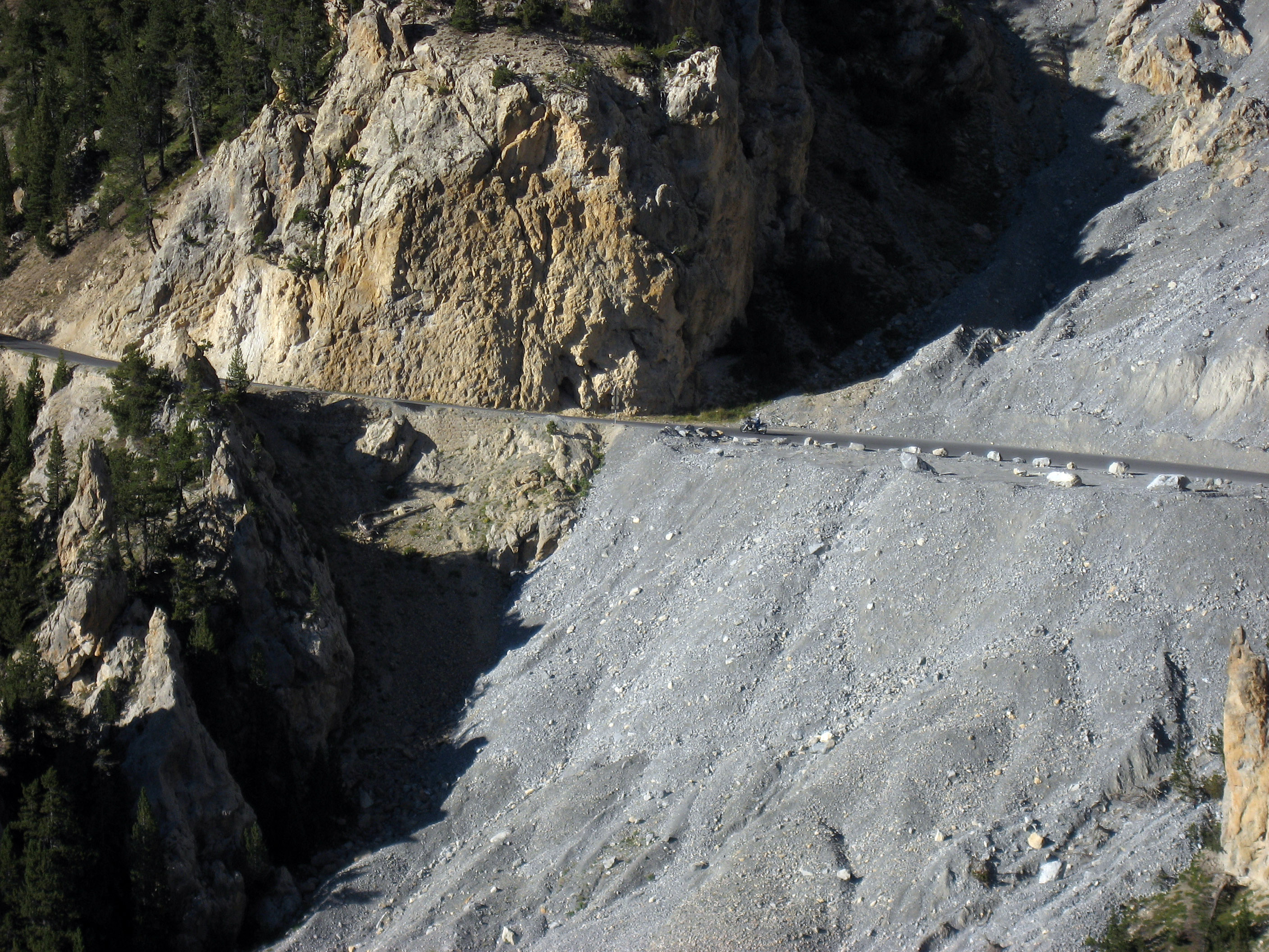
Still climbing up to Col d'Izoard, France on our BMW motorcycles.
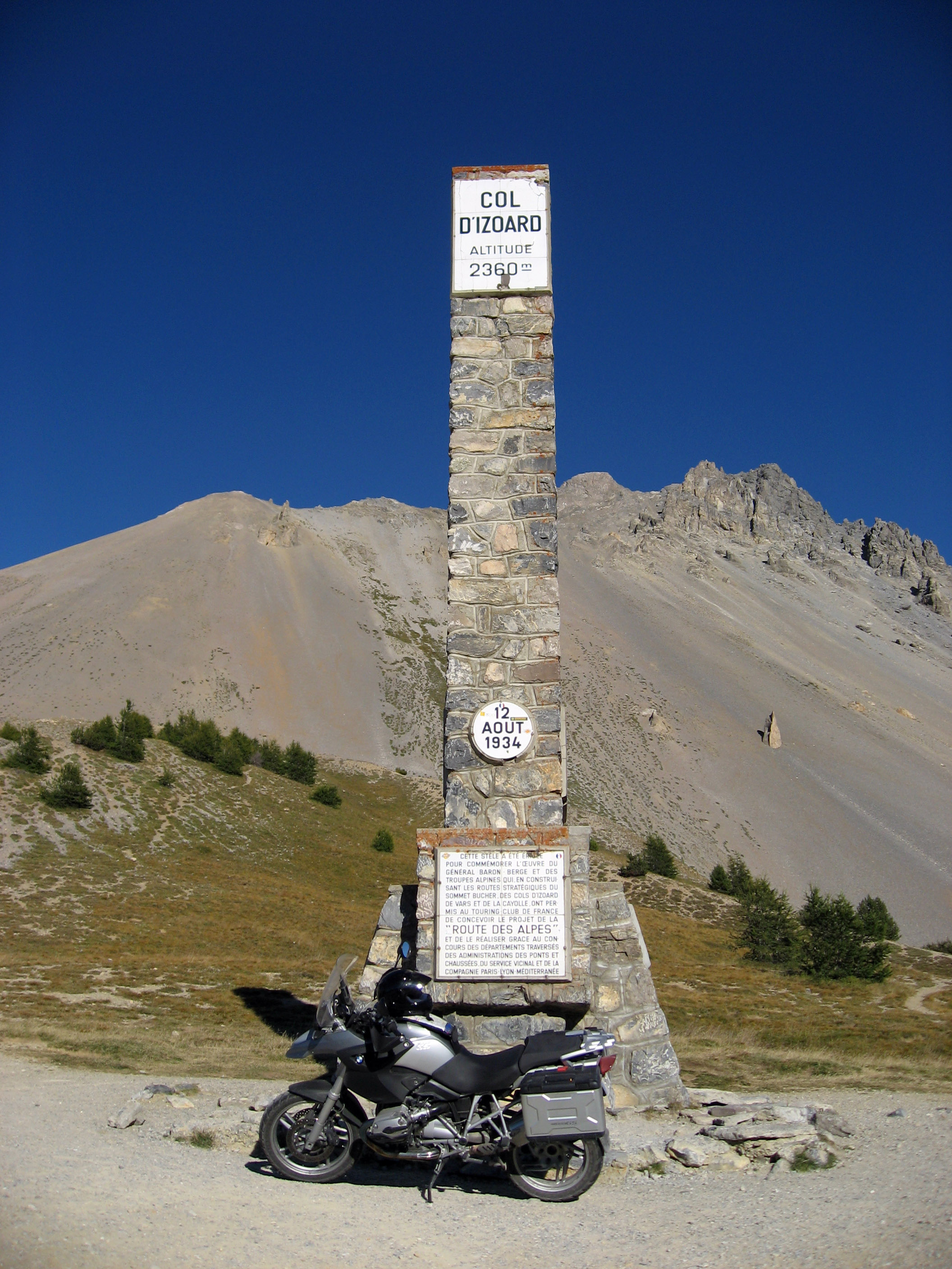
And we arrive at Col d'Izoard, France! That's my motorcycle below the sign at the summit of the mountain pass.
And on to the next mountain pass in France! :-) Below shows the road we just came up as we climb to Col Du Lautaret, France.
A panorama from about the same spot. The sun is going down, it is getting late.
And then the NEXT mountain pass in France. :-) The final one of the day, we're running out of daylight, so just this quick picture of Col du Galibier. After this we drop down for 10 minutes into the town of Valloire, France to our hotel for the night.
![]()
This webpage, and all of http://www.ski-epic.com are yours to enjoy. Feel free to use any pictures found here for any purpose you like, with or without credit. I grant you full rights, for free, forever, to do anything you want, including redistribute the pictures with or without any credit to me. This isn't my job, it's just my vacation website. Enjoy!
(Read
a personal
description of Backblaze here.)
END OF NEW ADDITION
![]()
Return to 2006 Europe Motorcycle Trip Top Level
![]()