2026 Bigfoot Trail Austin
(1/5/2026)
![]()
2026 Bigfoot Trail Austin(1/5/2026)
|
|
Behind my house in Austin there is a greenbelt call "North Cat Mountain Greenbelt", I found an old, abandoned trail somebody created at some point in the past. It was really overgrown with brush, so I cleared the brush away to reveal a pretty neat trail that was abandoned years ago. Below are some photos. You can click on any photo for higher resolution version.
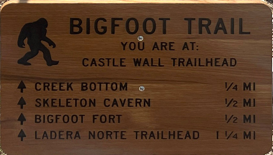
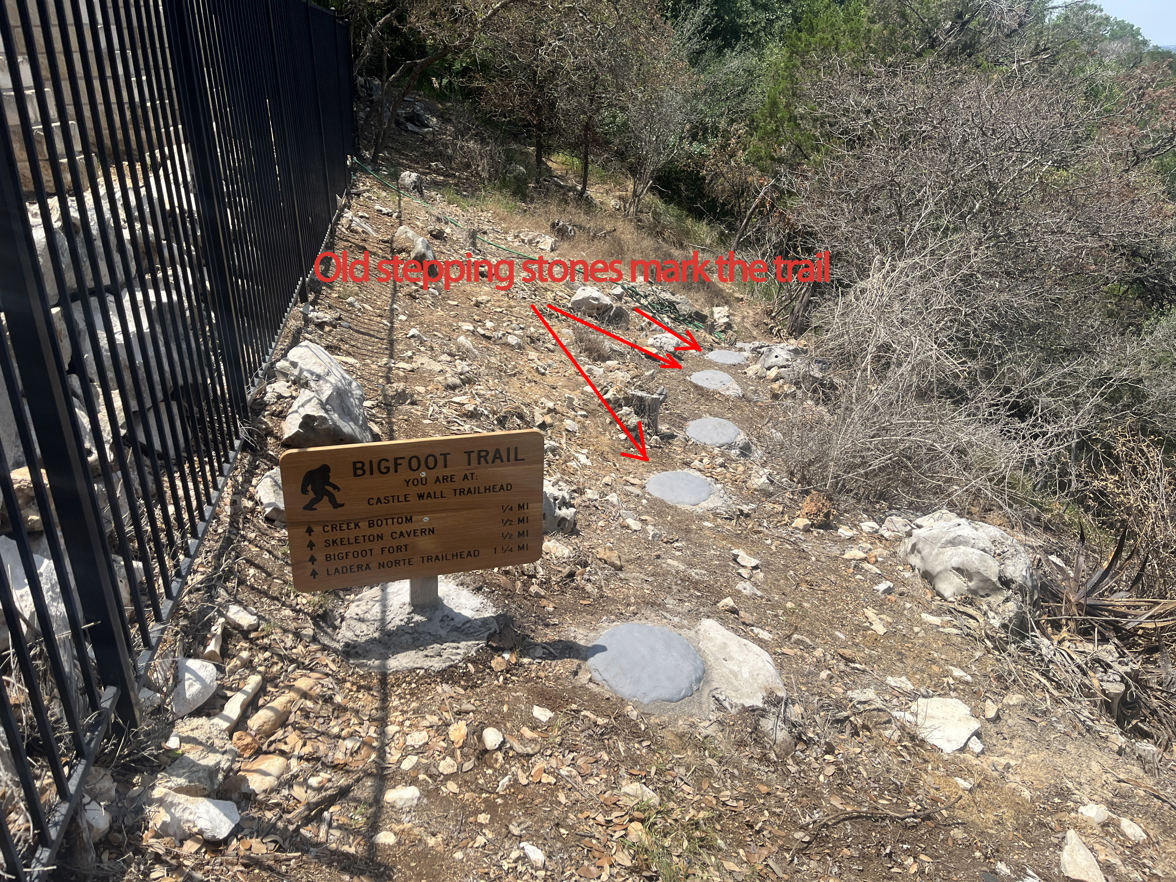
The picture below is taken just behind my house. The black metal fence to the left is on my property. The sign you see below was totally submerged in brush when I discovered it. One day I was just standing on my deck more than a year after my wife and I bought the house and moved in, and I noticed the old sign (in picture below) hidden in completely overgrown brush. I couldn't even read it at first, but I was curious what it said. So I cleared away the brush around the sign with a "lopper" I owned, and the sign (in picture below) appeared and the one little paver stone immediately next to the sign. Then I realized there was another paver stone a little way away and I cleared my way through the amazingly dense brush to the next paver stone, and so on. After weeks of clearing brush, this is what appeared:
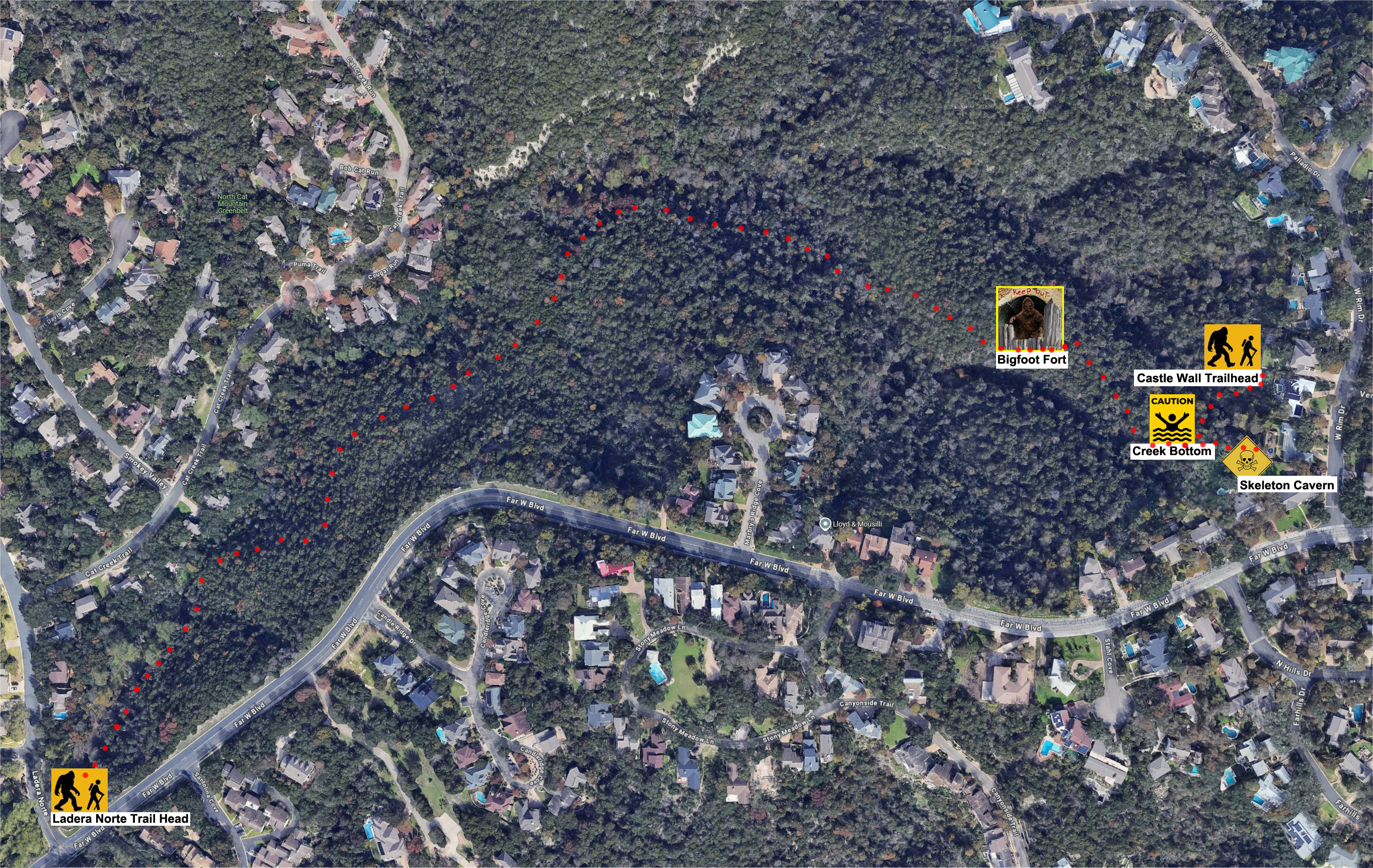
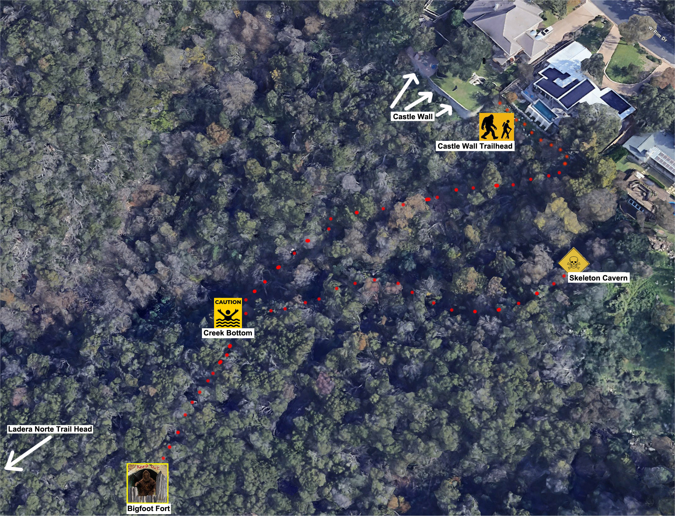
Okay, so this was really pretty fun, and the "locations" listed on the trail sign were a mystery. So I kept going, following the path, clearing brush. I even repaired a few spots in the trail where the stepping stones either never existed or the trail had "slid down the steep hill" in places. This was so impassable due to overgrown brush, progress is slow. I've been working on this for about a year now, and I have not fully uncovered this old trail yet, but I think (not totally sure) I figured out (roughly) the locations listed on the "CASTLE WALL TRAILHEAD". So below is my best guess as to a "map" of this trail. This might be totally wrong. Anyway, here is my best guess of the map of the trail superimposed on a satellite photo. Click on the map below for a way more zoomed in detailed version:
I eventually took a GPS loaded with topo maps along the trail, and created the topo map version of a trail map seen below. If you aren't that familiar with how to read a topo map, any one line you see is at exactly one "elevation". So if you follow one of the lines, you aren't going up or down. The important thing is the closer together the lines are, the steeper the hill. So from "Castle Wall Trailhead" to "Creek Bottom" it is very steep, and parts of the old abandoned "Bigfoot Trail" path had slid down the steep hillside. I have repaired a few spots because they were treacherous and I skinned up my legs a few times scrambling over that section of trail.
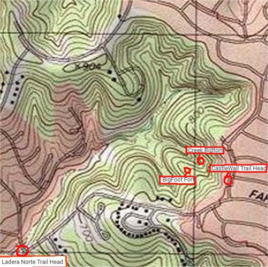
Below is a zoomed in section of the satellite photo version of the trail specifically of the area around the Castle Wall Trailhead. It took me months to figure out that the "Castle Wall" referred to a retaining wall on my next door neighbor's property that looks like a "Castle Wall" when viewed from below! That's hilarious! You can click on the map below to get a zoomed in version:
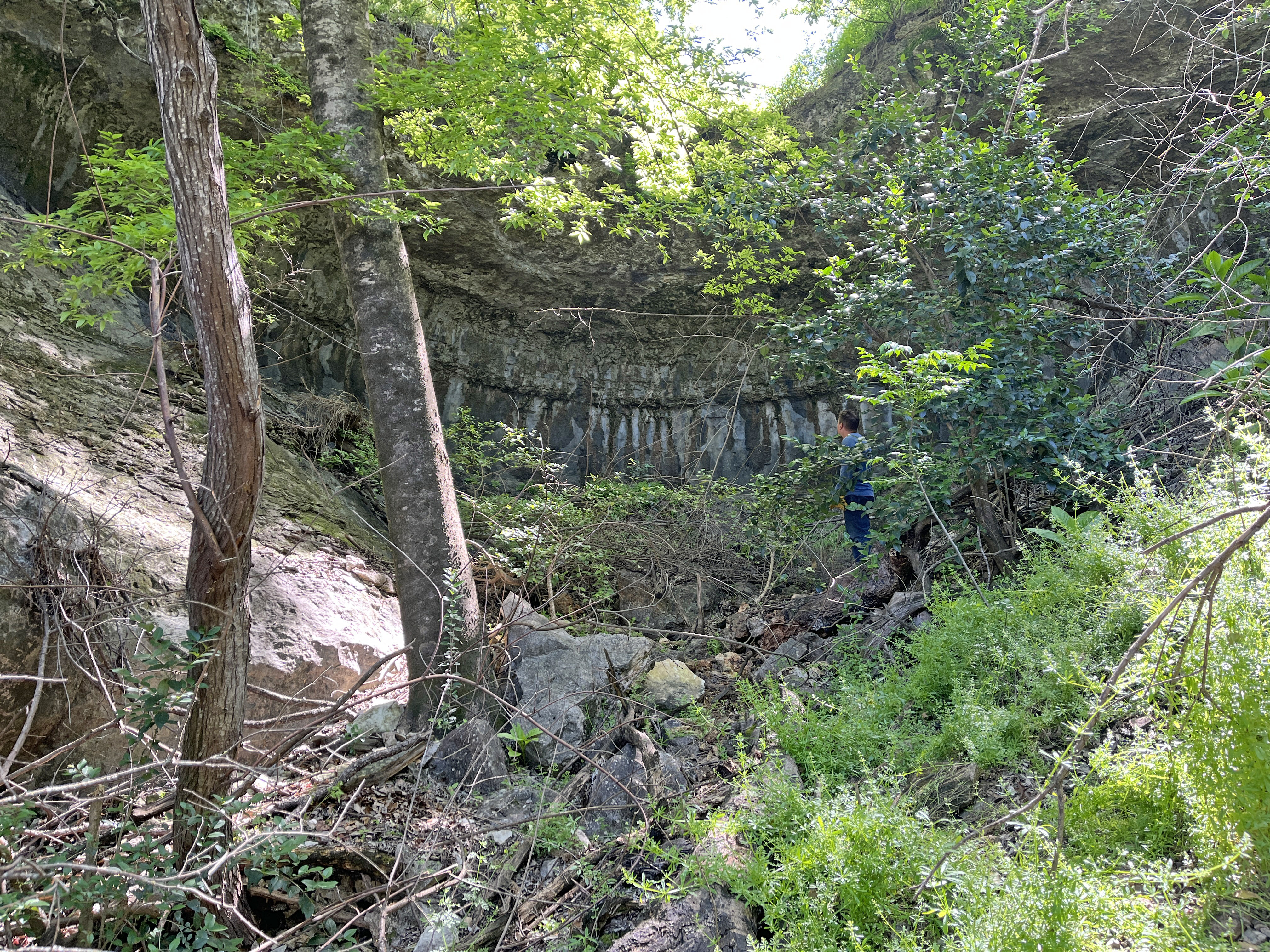
My buddy (Casey) and I fought our way through the brush one day to try to find "Skeleton Cavern". Below is a picture inside what I think is "Skeleton Cavern" off the Bigfoot Trail. In the picture below you can see Casey standing in the underbrush in Skelton Cavern.
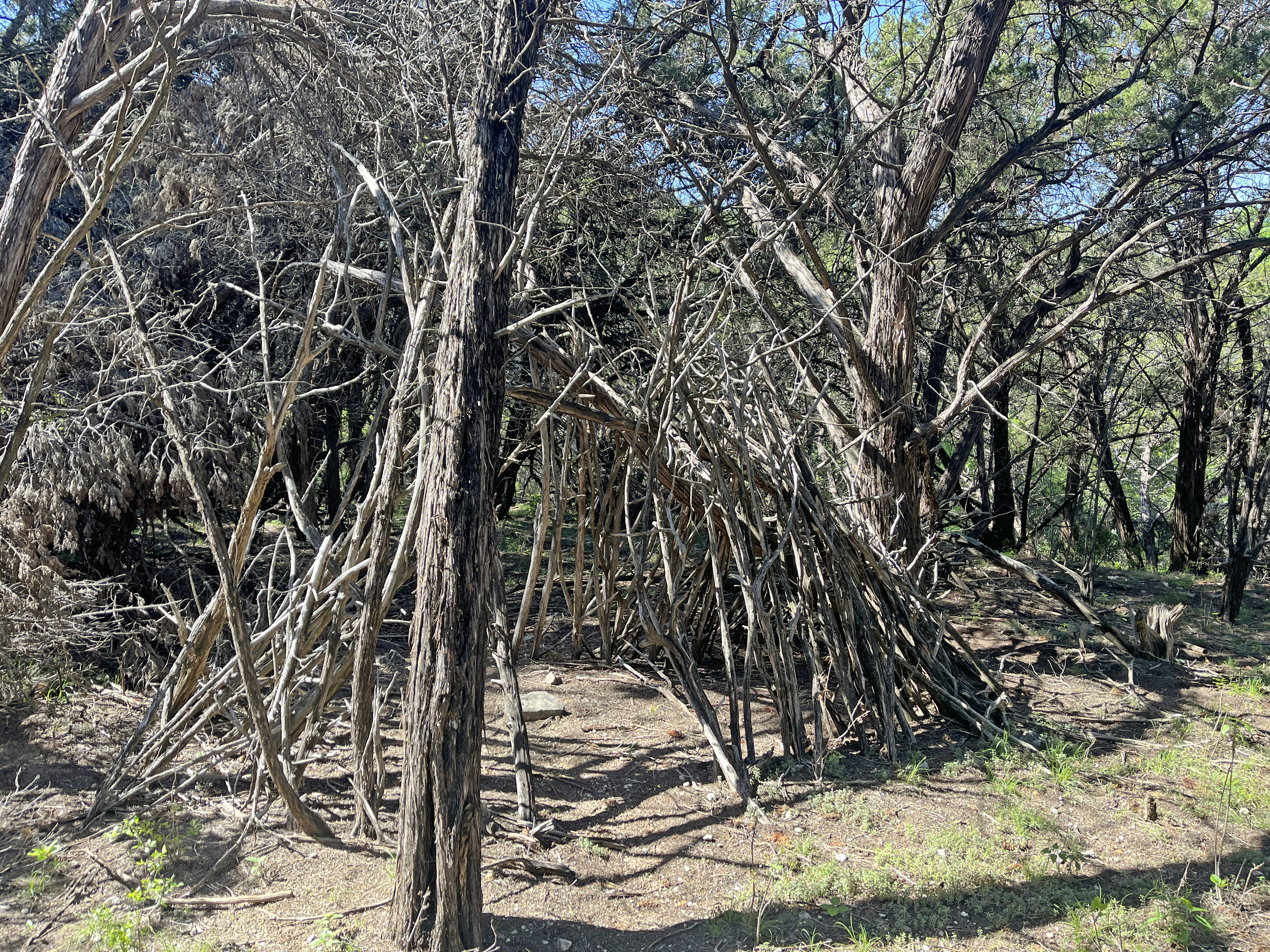
After several months of exploring, I think I found "Bigfoot Fort". I could be wrong, but it was such a surprise to see this "Fort" made out of sticks out here in the greenbelt, and it matches the distances on the original sign I found. Below is a picture of "Bigfoot Fort" which is found on Bigfoot Trail:
I still have more trail to uncover, and I'm not completely sure how Bigfoot Trail reaches the "Ladera Norte Trailhead". I will update this web page as I figure out more.
That's it! All done!
![]()